Tag Archives: gps

xyHt Weekly News Recap: 08/26/2022
Public Comment Requested on Revision to OGC 3D Streaming Community Standard Commercial geospatial technologies that detect GPS disruptions to be tested in military exercises Senators Urge FCC to Reconsider Order Granting Ligado Applications Civil GPS Service Interface Committee Meeting Set for September 19-20 EuroGeographics welcomes strengthened UN-GGIM Reveal Technology and Teal Drones Demonstrate Multi-Drone Mapping...

Refining Measurement
A land surveyor unpacks the concept of accuracy “Accuracy is addictive,” my friend David Doyle once said. Doyle is a geodesist by trade. For someone in his line of work, this addiction has a rich tradition. Geodesy is the study of Earth’s shape, rotation, and gravity field. The discipline involves an eternal quest to refine...

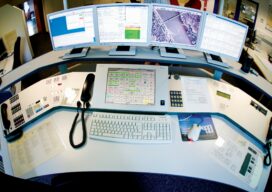
Upgrading GIS for a Better 911
The complex system of emergency call routing and critical location data delivery is getting a makeover Minutes can make a difference between life and death for 911 callers. A quick response with suitable equipment and knowledgeable personnel is the goal of 911 call centers across the country. However, managing calls and texts from mobile phones...

xyHt Weekly News Recap: 04/29/2022
NSPS Joins Coalition Effort to Raise Concerns on GPS Interference with President Biden and Congress Association for Geographic Information Celebrates Return to In Person Events White House Wants to Counter the Use of Drones in the U.S. USGIF Announces New Scholarships and a New Working Group Focused on Diversity, Inclusion, and Belonging Auterion Delivers New...

xyHt Weekly News Recap: 04/22/2022
Biden Administration Plays Up Billions for Rural Infrastructure AGI Welcomes Business Development Specialist Angela Arriaga Trimble and Infotech Expand Collaboration to Improve Inspection Efficiencies for Infrastructure CHC Navigation Introduces Airborne Lidar Series Drone Nerds Displays Emerging Drone Technology Solutions at AUVSI XPONENTIAL NSPS Cosigns USGS Streamgages Letter PAR Government and BlackSky Deliver Near Real-Time Imagery Russia is...

Capturing Today’s (and Tomorrow’s) Constellations
Access to all GNSS constellations provides better data, better results Enhancements made to improve the handling of satellite systems (also called constellations) and the increasing number of signals produced by these systems provide a tangible benefit to any solution that requires precise positioning. Depending on the time of day and the geographical location, some of...
