Tag Archives: gps
Citizen Geodesist
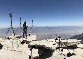
A GPS on Bench Marks odyssey Philip Melcher of Provost & Pritchard Consulting Group in Visalia, California, has submitted GPS on Bench Marks observations on an incredible 650 Bench Marks all up and down California in the last three years. We will ask Philip a few questions to find out how he has accomplished this,...

Let’s Get Something Straight
In my last Dis-Located column I wrote about the historic, economic, and unusual impact of the Potomac River dividing Maryland and Virginia, saying no other state border impacted either side quite like it. While that is true, several readers pointed out that there are other oddities among state borders created by surveyors or surveying mistakes....

22 Young Geospatial Professionals to Watch in 2022 – 14 of 22
Throughout January xyHt.com will feature the young geospatial professionals who are making a name for themselves in everything from surveying to geographic information systems. xyHt featured all of them in the January issue. Here we will spotlight one each day. Name: Ethan Schreuder Company: Woolpert Current Position: Survey Technician, UAS Subject Matter Expert/Pilot Age: 29...

xyHt Weekly News Recap: 01/14/2022
GEOINT 2022 Innovative Tradecraft Competition Entries Open Jan. 12 MdGroup Acquires GeoCue Group Riverside Mfg. to Assemble Commercial GPS Receivers in the U.S Golden Software Facilitates Map Making and Data Export in Surfer Package Esri Book Demonstrates How Maps Enable Cross-Sector Civic Collaboration Hexagon and Dayou Partner to Bring High Accuracy GNSS Corrections to China...

Affordable GNSS: Post-Processing Kinematic in the Cloud
In 1990 I had the privilege to work with a group of pioneers in Canada in the early development of land surveying techniques using a revolutionary new technology known as global positioning system or GPS. Back then, there was only a handful of satellites and the availability of a workable constellation that would allow for...

xyHt Magazine Digital Edition: December 2021
Like a good surveyor, xyHt‘s December issue covers a lot of ground. This month we bring you stories about surveying, lidar, legal issues and an in-depth look at the emerging post-processing kinematic technology. As always, if you don’t have a subscription to our print edition, or if someone else in the office has snaffled your copy,...