Tag Archives: RTN
How Accurate Is an RTN?
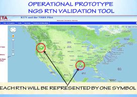
Many surveyors have realized the benefits of using real-time GNSS networks (RTN) for survey-grade positioning. Saving time, equipment, and personnel means saving project costs. The thing about real-time GNSS surveying, however, is that “rover expertise” needs to be applied in the field (not the office). Additionally, many factors involved with GNSS signalization, as well as...

Trimble Catalyst — No Receiver Required*
*A groundbreaking new service turns your smartphone into a high-precision, software-defined GNSS receiver. The new Trimble Catalyst is a little hard to describe in terms we’re used to regarding high-precision GNSS. Is it a receiver? Is it a service? Do we really need only an external antenna, a subscription, and a smartphone? The answer is...

40 Under 40, 2017: Bohan Wu
SUPPORT ENGINEER AT TRIMBLE GERMANY DO YOU EVER WONDER who support specialists at your dealers and manufacturers turn to when they’re stumped? Support engineers like Bohan Wu are the vital lifeline for them. People working in the product lines of Trimble infrastructure (reference networks and monitoring) sometimes characterize a technical conundrum as a “Bohan-level” question....

Rochester & Associates: In Control with VRS Now
Rochester & Associated uses precise on-demand positions to save time and money. Real-Time Networks (RTN) can be liberating: “When you get on a project site and have on-demand positions, there are so many more possibilities to get the job done rapidly and precisely,” says Jarrod Black, a licensed land surveyor and vice president at Georgia-based...

xyHt News Links: 6/24/16
Control Point Acquires Stantec Tri-State Survey & Photogrammetry Group GENEQ Announces New RTK App for iOS named iSXBlue RTN FAA: Commercial drone use to take flight Summit Outlines Steps for a National Parcel System Hemisphere GNSS Announces New Eclipse Positioning OEM Boards Airbus Defense and Space and 3v Geomatics Partner for TerraSARX Imagery Acquisition Program...