Rochester & Associated uses precise on-demand positions to save time and money.
Real-Time Networks (RTN) can be liberating: “When you get on a project site and have on-demand positions, there are so many more possibilities to get the job done rapidly and precisely,” says Jarrod Black, a licensed land surveyor and vice president at Georgia-based Rochester & Associates. In his 12 years with Rochester, Black has worked to boost engineering efficiencies at his firm by leveraging a broad range of surveying hardware, software, and integrated workflows.
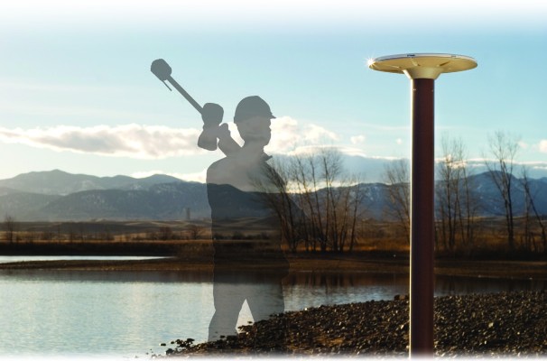
But it is a more recent addition to Rochester’s toolkit–VRS Now correction service–that has sparked excitement, revamped workflows, and yielded substantial cost benefits. Developed and operated by Trimble, VRS Now is a trademarked RTN correction service that uses wireless internet to provide centimeter-level GNSS positioning; the company also offers a trademarked precise point positioning (PPP) service called RTX for geospatial users using correction data delivered via broadcast satellites with precision of >4cm to 1m.. The service enables surveyors and other geospatial professionals to perform precise GNSS positioning in real time without the need for local GNSS reference stations. It is as simple as grabbing one of their RIOs, or other network-ready rovers like their R8s, and heading for the field. There’s no base to set up–and it’s transforming the way Black and his colleagues work.
Speed, Accuracy and Reliability
Rochester & Associates is a multi-disciplinary firm that provides surveying, civil engineering, project management, and infrastructure services across multiple states. Established as a surveying firm in 1966, it has grown steadily and recently added mapping and GIS capabilities.
But surveying is the core of the business; as Black notes, “Surveying and survey control is the foundation for every project.” The company establishes project control for each of its dozens of projects every year–large and small. Over Rochester’s 50-year history, the process of establishing project control has evolved dramatically.
For years, Rochester crews set control using legacy methods involving long traverses. The first change came with the advent of GPS in the 1990s. But even with static GPS, establishing project control still required many man-days of labor and multiple GPS receivers. Real-time kinematic (RTK) techniques could shorten the time needed but required at least two receivers and many hours to carry control from off-site locations. The emergence of RTK based on real-time GNSS networks (RTN) and, specifically, VRS Now, has changed all that.
Rochester has long been a Trimble customer, so using VRS Now was a logical progression. Each of Rochester’s survey crews is outfitted with an R10 or R8 GNSS rover. “This is usually the only equipment they need to take with them to go set control,” said Black.
We use VRS Now to set two or more control points per site, even in remote or wooded areas. It is rare that we cannot find enough open sky to set as much control as we need and almost wherever we need it.
Black is eager to utilize the advanced features of their R10s, like tilt compensation and Trimble xFill (to help fill gaps in areas of spotty cellular coverage). While Rochester uses these technology solutions exclusively, VRS Now works with any GNSS receiver that supports industry-standard RTCM communications protocols.
Black said that the access to on-demand positions eliminates challenges that they experienced with legacy methods. “When we would do long-static GPS observations and even shorter fast-static, there would always be some nagging doubt,” he explains. “We might not know if something went wrong until we processed the data in the office.” Those after-the-fact “gotchas” can be costly, notes Black. The drive time to job sites in Atlanta can be more than an hour each way and much longer for revisits to out-of-state projects. “On one project a bird had landed on an antenna set up for fast-static,” Black recalls. “We didn’t find out until later that the session had been affected.” Speed alone is not enough. Rochester’s clients need results that are precise, repeatable, and reliable. Black says that VRS Now gets high marks all around.
We can step out of the truck, fire up the R10, and, with its HD-GNSS and connection to VRS Now, we are ready to start storing observations with very low residuals.
Being able to set up and collect observations so quickly enables the crews to take many observations (or “shots”) in a short amount of time. “We can take multiple shots at the beginning of the day when we set control and more shots during the day and on subsequent days,” Black says.
With multiple shots together for each control point, we can calculate positional accuracies and add more confidence to our results.
This new method for establishing project control has yielded impressive cost savings for Rochester. The time spent establishing control can vary from project to project. Black says it can vary from 15 minutes to four hours–although the time difference often depends on how much time is needed to set the physical control point.
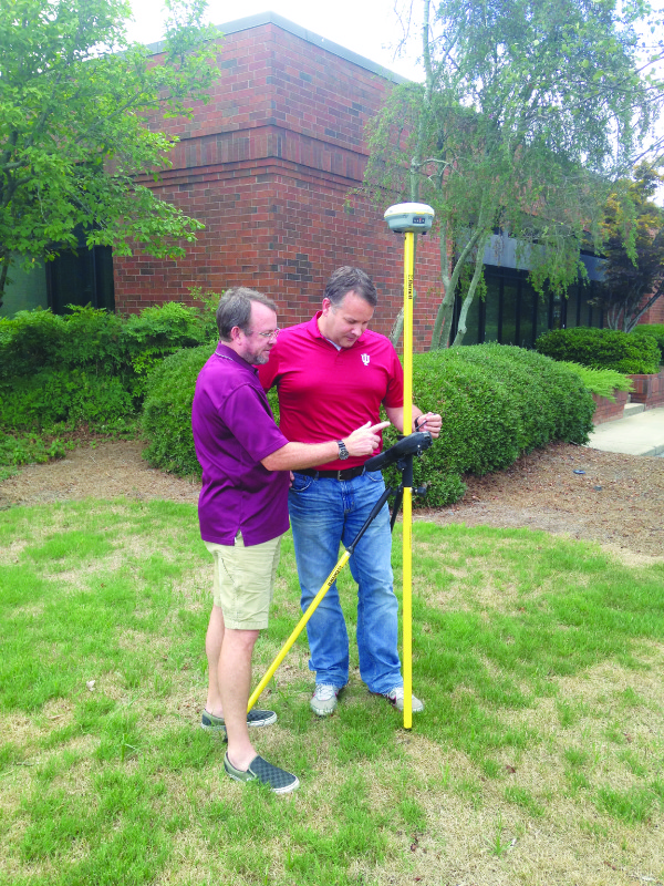
Jarrod Black (right) of Rochester & Associates gets tips from Mark Russell of local dealer Duncan-Parnell.
The VRS Now observations occupy a small portion of the time on site. Without the on-demand positions that VRS Now delivers, Rochester would need to add at least a full day and at least one additional surveyor to each job. “With as many projects as we do every year, that really adds up,” Black says. In realizing the productivity gains, Black’s subscription to VRS Now has delivered a rapid payback.
Rochester also sets control for positioning and machine guidance on construction sites. Black describes a typical scenario:
The folks running the machine control would often put a GNSS antenna up on a 6″ x 6″ post. Sure enough, someone would back a loader into it or hit their ground marks with a grader. Then they have to struggle to get the control all set up again.
We explain to them that our control is the VRS Now network. Because it is external to all of the construction clutter, no equipment will run it over. We can keep their site control consistent and quickly re-establish physical points when needed.
For Rochester & Associates, the benefit of VRS Now goes beyond a single product. Black utilizes an array of these integrated technologies and services across multiple work processes. “We get reliable results on the spot, but then when we add them to TBC [Trimble Business Center software], we can mix GNSS with traverse and topo data taken with total station,” Black says. “The integration improves the entire survey.” With on-demand positons, Access on their data collectors, and Business Center back in the office, Rochester surveyors are now able to see things that might have been missed decades ago. “There is a really great method for backing-in control from the rover position that is easy for our crews to understand,’ he says. “And the total station and GNSS shots can be processed together, tightening up the whole site.”
Framework for Precision
The VRS Now service provides a consistent reference framework across all of its service areas. In the U.S., VRS Now networks were coordinated using the most current iteration of the National Spatial Reference System, specifically to NAD83 2011 – epoch 2010.00 as published by the U.S. National Geodetic Survey. The surveyor does not need to resolve the coordinates for each location or struggle with old, obsolete, or possibly compromised local control.
Black recalls a recent instance where the consistency of VRS Now revealed troubling discrepancies. “We had a project that ran from one side of a county to another,” he says.
By the time we got to the other end, we could see that a lot of the old published control was off by as much as 5-6 centimeters (roughly 2 inches). VRS Now will be a great benefit to counties and cities and enable them to add new data and update their control networks.
When Rochester’s clients require a project to constrain to a local published control, Black says they can do a simple in-field calibration in Trimble Access on the controller. For larger projects, the surveyors can use Business Center in the office to do a more comprehensive analysis.
Real-time networks have been around for several years and are operated by various states, localities, and private firms. Rochester has used alternate networks in different states where VRS Now service has not yet been established. The experience with some of these other networks, Black notes, has not always been positive.
We have worked in one state where the network had been down as much as a week at a time. We have yet to run into a situation when VRS Now was not available.
With full-time network operations centers in the U.S., Europe, and Asia, VRS Now has round-the-clock network monitoring and support via phone and email. But Rochester has yet to take advantage of the support services. “We have never had anything go wrong,” said Black.
Rochester has standardized on hardware and software, and Black emphasizes the added value of integrated solutions and the ability to work with one source for support and service. “We work with our local distributor Duncan-Parnell; we’re very happy with the service,” said Black.
If we have a question they cannot answer, they get the manufacturer involved very quickly.
VRS Now users have found a lot of applications for on-demand positioning. For Jarrod Black and Rochester & Associates, the reliability of VRS Now has proven its worth and has fundamentally changed the way they establish project control. Will Black try VRS Now for other tasks? “Of course!” he says. “We’re just getting started.”