Tag Archives: surveying
Education in Surveying: Improving the Geospatial Learning Experience: GeoLearn
GeoLearn is an online education company founded in 2013 and designed to improve the learning experience for busy professionals and technicians in the geospatial professions. Joe Paiva, PhD, PS, PE, a long-time geospatial industry educator, and Robert Morris are principals of this start-up educational company. The company’s initial slate of professional development courses, announced at launch...
Feature: Preparing to Fly
An industry insider provides an overview of the advantages of using UAS for surveying as well as common misconceptions, plus preparation steps for surveyors and firms.Unmanned aircraft systems (UAS) represent a culmination of advancements in miniaturization, electronics, optics, batteries, and data-processing techniques. After being widely used in military and security operations for the past 10...

Protecting Water Purity
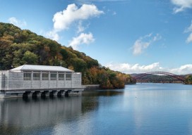
Above: Croton Lake Gatehouse at the Old Croton Reservoir in Westchester County is the oldest part of the city’s current water system. At the reservoir’s construction in 1842, it had the capacity of delivering about 90 million gallons of water per day to the city. Surveying the NYC Watershed Where does the water you drink...
Feature: Under Thin Ice
An exceptional set of explorers surveys the caves inside a dying glacier on the side of Mt. Hood in Oregon. All photos courtesy of Brent McGregor, except where noted. Editor’s Note: High-profile scientific questions permeate the public consciousness, and surveying, mapping, and field data collection are the “ground truth” element of geophysical scientific research. This...
The (New) National Conference
Publisher’s Note: Two of our organizational partners, NSPS and MAPPS, announced the launch of a national geospatial conference this spring. We invited the incoming NSPS president to tell us what to expect and why we should all participate. Everything starts somewhere, or—in the case of a national surveying/geospatial conference—it must be reborn somewhere. So, why...
The Political Surveyor: Defining “Geospatial” for Today’s Education and Tomorrow’s Workforce
The traditional surveying and mapping profession, which today is more commonly known as “geospatial,” has an identity crisis. While the profession was long considered part of the broad field of engineering, the geospatial community today lacks a common and accepted definition and classification. This could adversely affect its future workforce and hundreds of millions of...
