Tag Archives: Trimble

xyHt News Links: 7/8/16
Reduction of the Nationwide Differential Global Positioning System (NDGPS) FAA to Answer UAS Rule Questions at MAPPS Summer Conference Trimble R2 GNSS Receiver Now Available for Data Collection Trimble Adds Fully Automated Scheduling Capabilities to its Advanced Solution for Field Service Management Dewberry completes US hydrography study for business uses, requirements

xyHt News Links: 7/1/16
Topcon announces improved efficiency with Autodesk workflow Septentrio Offers Enhanced Georeferencing Solutions for Drone Aerial Surveys Let’s Make the World a Better Place with Maps Trimble Announces Release of TDC100 Handheld GNSS Data Collector DigitalGlobe and Esri Announce New Long-Term Partnership to Expand World Imagery Map Spectra Precision MobileMapper 50 Combines Smartphone Design with Professional...

xyHt Industry News Links: 4/29/16
Tallysman® Introduces High Performance Triple Band GNSS Antenna + L-Band Trimble Launches End-to-End Field Service Management Suite DJI Introduces Next-Generation Matrice 600 Aerial Platform NovAtel launches 40-centimeter correction service, TerraStar-L The Digit Group and CyberCity 3D Ink Development, Sales and Marketing Agreement Using Streaming 3D Maps for Smart Cities IoT Solutions MIT Develops Control Algorithm...

xyHt News Links: 4/22/16
3D Robotics Announces Transformative New Software for the Solo Smart Drone Platform Topcon and RDO announce expansion to GNSS network service Trimble Announces Call for Speakers for its 2016 Dimensions User Conference Introduction of complete propulsion systems at Xponential 2016 Investigation launched over possible UAV/airplane collision Leica Geosystems launches smart antenna with superior performance DJI Unveils...

BIM: Some Assembly Required (But not as Much as You Might Think)
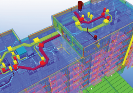
Above: A 3D model combines building structure, systems, and site data. Trimble’s Bryn Fosburgh Talks BIM Editor’s note: From a distance, BIM looks like it would present quite a challenge to implement: how to affect smooth and efficient workflows encompassing diverse and complex elements. As surveyors and other geospatial practitioners try to get their arms around...

xyHt News Links: 4/1/16
East View Now Offering PlanetDEM 30 Plus Trimble Seismic Navigation Systems Support Stakeless Operations for Geophysical Exploration Boundless Launches Complete Open Source GIS Platform for the Enterprise Driverless Conference sparks autonomous car development analysis FARO® Introduces World’s First 3D Scan Localizer and the First FARO Innovation Product Introduction in FARO’s new Early Adopter (EA) Program...
