Tag Archives: uas

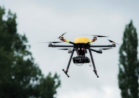
1,500+ Flights
Can an owner/operator sustain a thriving business using only UAS? It’s happening in New Zealand with orthophotography of farmland. After little more than four years in the orthophotographic business, Chris McFadzean, owner/operator of Epiphany Mapping in New Zealand, has logged more than 1,500 UAS flights. This makes him one of the most experienced UAS pilots...
Multicopter Profiles
The eXom, RiCOPTER, Aibot X6, and Trimble ZX5 SenseFly’s eXom Inspection and close-in mapping sUAS I first saw sensFly’s new eXom sUAS at the ILMF conference in Denver early this year. It’s billed as an inspection and close-in mapping platform, and I thought, “Inspection? That’s interesting” and moved on. Turns out the team at senseFly...
Getting Beyond VLOS
The FAA’s streamlined Section 333 exemption and COA process is welcome, but there’s still a fly in the ointment. While the ongoing FAA Section 333 exemption process is a big step in the right direction for UAS, all operators flying under these exemptions are constrained by the VLOS rule: all flights must be conducted within...
We Are Aviators First
With UAS, surveyors are becoming aviators. As we adopt new technology, we should heed old advice. I flew my first photogrammetric mission in the early 1980s while I was completing my geodesy degree during tumultuous times at my alma mater. While the rest of the world had disco fever, students at Universidad Central de Venezuela...

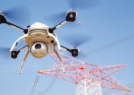
Copter Power
A UAS rotocopter pilot directs the successful imaging of a breakwater project in Costa Rica. Unmanned aircraft systems (UAS) are finding their way into geospatial applications beyond the obvious commercial topography, volumes, and inspection applications. One particular application that is poised to take advantage of the lower cost associated with UAS data acquisition is environmental...
Trimble Takes Flight with New Multirotor Unmanned Aircraft System
Latest Addition to UAS Portfolio Makes Working in Tight Spaces Easy Trimble announced the ZX5 Multirotor Unmanned Aircraft System (UAS), a new aerial imaging and workflow solution that captures and processes geo-referenced photo and video data for mapping, agriculture and inspection applications. The Trimble® ZX5 complements the UAS portfolio with the ability to reach smaller,...