Category Archives: Lidar/Imaging
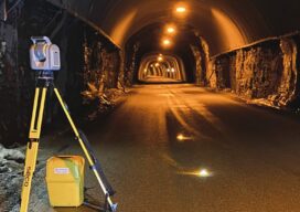
Tunnelling to a New Approach
A surveyor switches from conventional technology to the Trimble SX12, enabling her to match the frenetic pace at six times the speed of multiple-person crews.
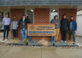
Uncovering History
Cincinnati State students preserve a pre-European Native American historical site in Indiana Some members of the 2021 land surveying class at Cincinnati State have been busy bringing history back to life near the city of Lawrenceburg, Indiana. This team of students had the opportunity to survey the site of a village where indigenous people lived...

Stepping Down
Surveyors sorry to see NSPS executive director Curt Sumner retire As word filters throughout the surveying community that National Society of Professional Surveyors executive director Curt Sumner is stepping down, accolades for the job he’s done over more than two decades in the position come pouring in. “Curt has been a friend and colleague for...

Out to Sea with Dr. Larry Mayer
Long-time oceanographer shares insights about mapping the ocean floor and the innovative technology needed to do it.
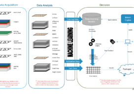
How Deep Learning For Remote Sensing Produces Quicker, Higher-Quality Results
As the volume, velocity, and variety of the data generated to address worldwide geospatial needs has steadily grown, advances in the systems and algorithms needed to produce spatial and temporal resolution data have not kept pace.
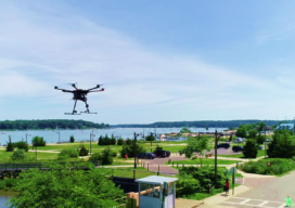
Walden Environmental Engineering Captures New Insights and Revenue
Emesent Hovermap was used by Harkin Aerial to conduct internal and external scans of assets for Walden Environmental Engineering. This resulted in simplified and streamlined projects with improved efficiency.