Australian firm Soar has been growing an interactive portal that is like a sophisticated Dropbox-eBay-Google Earth mashup where you can buy multi-platform imagery and maps from global and local resources.
And, on Soar, you can post your own aerial and UAS images for resale. They’ve just added access to imagery from the SuperView satellites—50cm resolution tasked images at $10 per km² and archived for $6 per km² .
While not a completely unique service, the earth maps and imagery provider Soar has been growing its marketplace of aerial, UAS, and satellite imagery. “After successful image capture, imagery is stitched, georeferenced, and delivered as a single natural color mosaic,” explains Soar CEO Amir Farhand. “Meaning, there is no more mucking around with raw files”.
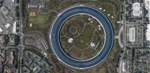
Apple’s “Spaceship” HQ captured at 50cm by the SuperView satellites
Individual UAS operators, to large aerial firms can add their aerial images and offer them up, via various pricing models negotiated with Soar. But they also offer access to global land regional image sets. In a way it is like a geospatial imaging “swap meet” (but without the junk).
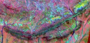
Multi-spectral images: Robinson Range in Western Australia
There are also collections of geo-registered thematic maps, multi-spectral, lidar elevation, and historical aerial images. The map interface has tools like KML import, and markup.
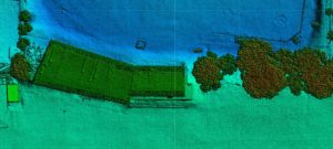
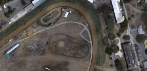
Lidar elevation model (captured by Yellow Scan)
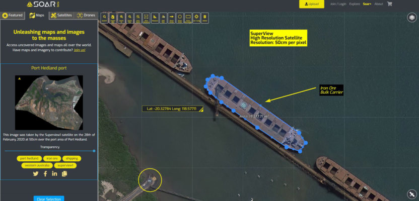
Soar already offers NASA’s Landsat (30m per pixel) and the European Space Agency’s Sentinel (10m per pixel) images, which Soar continues to provide global access to, free of charge. They will eventually be adding access to global images from other sources (via various partnerships and pricing models): NOAA, JAXA (Japanese Space Agency), Stealth Imaging. But on June 5th, 2020 they have announced the addition of images from the SuperView satellites (a constellation of four launched in pairs in 2016 and 2018) in cooperation with the Chinese Aerospace Science and Technology Corporation (CASC). These sun-synchronous satellites operate at an altitude of 500km and can monitor daily, any location on the Earth at 50cm per pixel image resolution.
UAS image, Barbados. Captured with a Delair UX11
“Partnerships with global imagery organizations allow for a unique supplier to end-user access via the Soar platform. The benefits are twofold. The opportunity for CASC is direct access to the huge international market for satellite imagery via a turnkey, easy to use solution. For Soar, it is the privilege to showcase the tremendous leap the Chinese space program has made in providing extremely fast turn-around high-resolution satellite imagery at incredibly low prices”, explains Soar CEO Amir Farhand.
New tasked SuperView satellite imagery is fast-tracked and delivered directly to the customer through Soar for $10 per km², and archived images going back to 2018 for $6 per km².
And to promote the launch of their service providing SuperView images, Soar is offering up free images (to the first 50 customers) of archived SuperView images of up to 50 km² beginning at GMT+8 on June 9th—only for 24 hours or until the first 50 orders are filled.
You can check them out at: https://soar.earth