All posts by Ernest Yap
App Happy: Streaming Utility Surveys
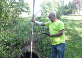
A new app standardizes workflow by turning a list of surveyed points into underground 3D utility maps. Imagine that you’re surveying an underground waterline in your city. You use your survey devices to record the locations of the pipe system, including the manholes, the water valves, and their depths. Using your tablet on-site, you’re able...

Pokemon Go: Geospatial Data, All the Time
We want integrated, interoperable systems that are robust and cost-effective Geospatial technology is so entrenched in our daily routines that we often forget we’re using it. I search for map directions at least once a day, whether for a restaurant or for a time of arrival to my daughter’s daycare. And millions of people have...
UAS & The Combo that Opens Access
The most logical integration of technologies for surveyors is combining 3D laser scanning with UAVs. It’s no secret that many geospatial professionals are enamored with unmanned aerial systems (UAS). For many years, the pros and cons of deploying small UAS for mapping and surveying, along with their ongoing regulatory discussions, have been well researched and...

(Nearly) Symbiotic
Above: A 3D laser scan inside a facility, which will be processed into a BIM 3D model. Credit: 3CON, LLC BIM is quickly advancing for construction and survey. As long as humans have built environments, they have been surveying. And as the human imagination has spurred increasingly complex constructions, land survey tools and techniques have...

Indoor Positioning
The next frontier in personal navigation poses both limits and promise. Imagine that you’re disembarking from an airplane at Chicago O’Hare airport. You have a connection to Seattle for an important customer meeting. Your smartphone begins to buzz; you’re informed that your connecting flight is pre-boarding. But you’re not worried. Your smartphone provides indoor directions...

Mapping as a Service
Fueled by the convergence of cloud computing, digital automation, and internet distribution, subscription mapping creates new opportunities. Subscription aerial mapping sets out to rid the industry of its dated legacies. One in particular is the commissioning of aerial mapping projects. The process can be bureaucratic, expensive, and subject to a long approval. This could lead...