All posts by Gavin Schrock
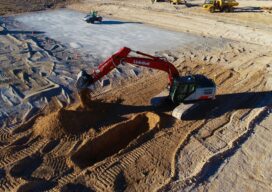
The Construction Automation Continuum
It’s more about many minor triumphs than major leaps. Surveyors can play an essential role in implementing these changes To those outside of the industry (and some within), the term “construction automation” evokes visions of bots and autonomous equipment plying construction sites—efficient and tireless—yet always on some far horizon. In present reality, construction automation takes...
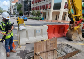
Disruptive Lidar Tech
Technologies developed for autonomy and consumer applications are opening up new user segments and rewriting conventional workflows A construction inspector sweeps their phone over an open trench creating a 3D as-built of the utilities within. This is just one example of low-cost, rapid, simplified reality capture is challenging conventional wisdom on how reality capture should...
UAS Processing as a Service
Speed, improved workflows, scalability, and analytical tools have boosted the popularity of such services—especially in these times of staffing challenges Creating deliverables from your UAS captured data, orthophotos, point clouds, photo meshes, and terrain models, can put a premium on the skills of your staff and processing resources. This is why an increasing number of...

UAS and ALTA Surveys
Part 3 Precision, accuracy, and completeness are the end goals of UAS post processing, but how you get there to meet ALTA standards requires extra care. In Parts One and Two of this article in the September and October 2022 issues of xyHt we looked at the time/cost/precision proposition of using UAS for elements of...

UAS and ALTA Surveys – Part Two
Surveying firms that have been successful in incorporating UAS data in ALTA surveys adopt best practices to ensure precision standards are met. Plan, execute, and check. In Part One of this three-part series in the September xyHt issue, we looked at the time/cost/precision proposition of using UAS for elements of ALTA surveys. Firms interviewed agreed...
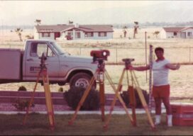
Boundaries: For the Love of Surveying
A memoir of the field, family, friends, fortitude—and fun Anthony “Tony” Vetturelli’s recently published memoir, Land Surveyor – Journey, Challenges & Destiny, is a fascinating personal journey, a life-long passion for surveying, and a first-hand chronicle of a particularly impactful epoch in the history of surveying. It’s the story of a kid who immigrated from...