All posts by Nicholas Duggan FRGS Cgeog (GIS)
Improving GNSS in the Urban Canyon
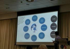
To prepare you for the this blog post, I wish to point out that I am a geospatial expert and can hold my own around the ins and outs of survey, so going to an event at the Ordnance Survey on “3D mapping for the improvement of GNSS in urban areas” was an eye-opener. You...
Esri CityEngine: What Is It?
These past few weeks I’ve been trying to do some clever augmented reality stuff with Unity involving putting an object on the floor and ensuring it doesn’t wobble when you walk around it. (Yay for SLAM in mobile devices.) Although in software like Unreal and Unity you can download or buy models, what do you...
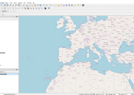
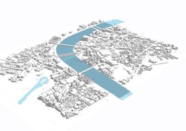
Using OpenStreetMap Basemaps with QGIS 3.0
QGIS 3 is a new wave of open source GIS. Not only is it extremely quick and efficient, allowing you to use almost every type of geospatial data you can throw at it, but it also includes a 3D renderer and ways to export your creations straight to the web. And let’s not forget the...
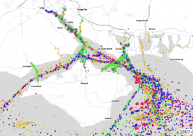
AIS: Using Shipping Data in GIS
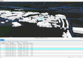
We’ve all been dazzled by those awesome maps that animate ships or aircraft using AIS, as they move in near real time, but how do they work? What magic sits beneath the hood? As luck would have it, whilst working with the offshore wind farm industry I had to do a lot of vessel analysis,...
Minimum and Maximum Z Values in ArcGIS Pro
In ArcGIS Pro, why are my minimum and maximum Z values wrong, and how do I fix it? Until recently, this isn’t the kind of question you would expect a GIS user to ask. Of late there have been many innovations in the geospatial software world, and the GIS user is now having to come...
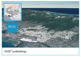
GD3D® Signs Innovative Data Agreement with CyberCity3D™ ahead of ArcGIS Marketplace Launch
(Cumbria, UK) January 23, 2018: GD3D® Signs Innovative Data Agreement with CyberCity3D™ ahead of ArcGIS Marketplace Launch PRESS RELEASE: GD3D®, the geospatial arm of Garsdale Design, is a leading 3D GIS consultancy based in Cumbria, United Kingdom. Today an agreement has been signed with CyberCity 3D Incorporated, a California 3D geospatial content company, to resell premium...