All posts by Scott Martin

Are HARNs on Death Row?
In the late 1980s, the National Geodetic Survey (NGS) launched a program, in cooperation with State partners, to establish a High Accuracy Reference Network (HARN) across the United States. HARN’s History With the rapidly increasing availability and use of GPS equipment, NGS recognized the need to establish a network of high-accuracy, passive survey monuments with...
Trial by Fire: First Party Chief Experience
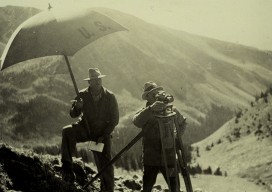
As we ponder the many challenges presented by the rapid transformation of the land surveying profession, the topic of mentoring often comes up. I have written about that topic a couple of times in past editions of Field Notes. (The image above is Whisky Pass Colorado, 1935. Credit: NOAA National Geodetic Survey.) I attribute much...

The Young Surveyors on the Young Surveyors Network
Note from Editor Scott P. Martin: As I read and absorbed the Young Surveyors Network response (below) to last month’s Field Notes, I realized that I have been ignorant of the perception and perspective young surveyors have of our profession and the old guard. We have contributed greatly to our own demise (I touched on...
Your Local Knowledge Is King
Although the adage, “Your local knowledge is king,” could apply to other professions or even trades, I think it is especially true in our profession. When a surveyor practices in a given area or region, or possibly an entire state, knowledge is gained and lessons learned about many things that determine one’s ability to remain competitive,...

Surveying States: Different, Yet the Same
With the President’s Day holiday recently behind us, a day I refer to as Surveyor’s Day (think Mt. Rushmore) and National Surveyors Week starting on March 18, 2017, I can’t help but think about surveyors across the United States as a whole. Although my entire professional practice has been in California, over those years I have...
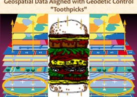
GIS Technology: Get It Surveyed
As I approach my 30th anniversary of being a licensed professional land surveyor in California, I can’t help but think about how things have changed over those years. One word: Technology. It has changed everything. For me, it started with EDMs, then total stations. Handheld calculators were emerging. When the HP 41-CX came out, that...