
Blog
Cross-Pacific Ties and A Disturbed Monument
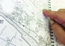
Above: The surveyor who set the original stake in Hyu-ga, Japan shows the spot in the Zenrin map book of the Miyazaki Prefecture. Located 28,280,841 feet +/- from original location. Editorуs note: A chance discovery by an Oregon beachcomber has forged cross-Pacific ties between two coastal cities–and their respective surveying communities. A few months ago,...

Autodesk University: BIM Preview
Autodesk Previews How “Connected BIM” Will Shape the Future of Work in the AEC Industry From the Autodesk press release: AEC professionals attending Autodesk University to experience the next evolution of BIM At this year’s Autodesk University, one thing will be abundantly clear – Building Information Modeling (BIM) is the nexus of designing, building, and...

xyHt News Links: 11/11/16
Trimble Software GNSS Receiver Provides High-Accuracy, On-Demand Positioning-as- a-Service Lead’Air Creates an Unparalleled Multi-use “HELIDAS” Oblique Camera System for Helicopter and Fixed-wing Aircraft Caterpillar and Trimble to Expand Mining Technology Collaboration Microdrones™ partners with Delair-Tech to offer complete aerial mapping toolkit Trimble Business Center Software Adds Scanning Module, Support for Complete Third-Party Data Integration and...

3D Software, Not Really Like CAD at All
Above: InfraWorks 360 uses engineering rules to ensure that vertical and horizontal curves in infrastructure elements have the proper radii. Take a close look at Autodesk’s InfraWork’s 360, an unusual 3D modeling software. Editor’s note: For many firms and practitioners of surveying, photogrammetry, mapping, and remote sensing, traditional deliverables to AEC clients have focused on...
UAS Surveying without GCPs
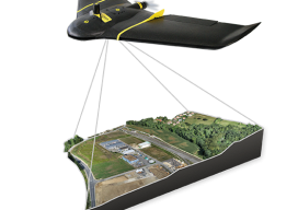
The subject of applying direct georeferencing to UAS platforms was a recurrent theme at the 2016 Commercial UAV Expo last week. Direct georeferencing offers the possibility of mapping without the use of ground control points, providing UAS operators a significant advantage in terms of speed. As an example of this technology, we reached out to...
Surveying Merit Badge
Surveying students jump into recruiting by hosting a surveying merit badge day. There are few challenges facing the profession of land surveying today that are as great as the need to revitalize our ranks with young and technologically savvy individuals. We all recognize the aging of our colleagues but cannot seem to identify the reasons...
Advertisement