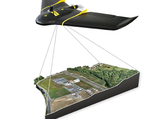
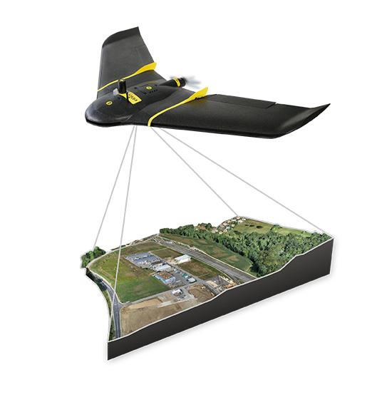
The subject of applying direct georeferencing to UAS platforms was a recurrent theme at the 2016 Commercial UAV Expo last week. Direct georeferencing offers the possibility of mapping without the use of ground control points, providing UAS operators a significant advantage in terms of speed. As an example of this technology, we reached out to Francois Gervaix, senseFly vertical manager, surveying and construction, who explained how the concept works in the new eBee Plus RTK/PPK.
Pangaea: Could you briefly explain how PPK works in combination with RTK in the new eBee Plus?
 Francois Gervaix: PPK is a completely hassle-free way for a user to achieve survey-grade absolute accuracy in eMotion 3. There is no preparation in the field required—the raw GNSS data are logged by default—and the user’s choice of base station is a wide one. They can position their own base station—any brand and the data exchange will be done in RINEX (Receiver Independent Exchange Format)—on a known point, or on an unknown point (with the determination to be done later in eMotion 3), or using a CORS (Continuously Operating Reference Station) to be chosen and downloaded later. This approach complements any RTK operation nicely, in the sense that PPK will always be available should there be any issue with the availability of RTK corrections. PPK is an operation mode in itself (e.g. for vast areas) and effectively functions as a safety net, a fall-back, for RTK operations.
Pangaea: Concurrent with the release of the eBee Plus, your eMotion 3 flight and data management software was introduced. What advantages does eMotion 3 have over its predecessors?
Francois Gervaix: eMotion 3 is truly 3D, graphically and numerically. This makes using the software and planning and managing missions highly intuitive. eMotion 3 also features multi-flight missions for highly efficient operations, where you just land, swap out the battery, re-launch (by hand), and the drone automatically continues along the same flight path from the same point. Plus you have multi-zone missions for mapping various sites in a particular region in one flight, while pre-defined, specific sub-missions (which we call mission blocks) are of great help for flight planning and execution, whatever the senseFly aircraft or payload. Last but not least, eMotion 3 is tightly connected to the cloud, be this for flight preparation or flight processing (for example with Pix4D Mapper). We call eMotion 3 the connected center of your drone workflow.