
Blog
History Corner: John Wasson: Surveyor General in Apache Land, Part 1
Arizona was made a separate surveying district on July 11, 1870. It was a momentous occasion for the young territory. Governor Anson P. K. Safford, newly appointed after his stint as surveyor general of Nevada, recommended his Nevada friend, newspaperman John Wasson, for the new position. At his side in the recommendation of Wasson...
Editor’s Desk: Lobby Day
This past November, Thursday the 21st, was the annual Lobby Day for the National Society of Professional Surveyors (NSPS). Held in conjunction with the semi-annual meetings of NSPS’s Board of Governors and Board of Directors, this is an opportunity for representatives of the surveying community to meet with their state’s members of Congress and their...
Stories from the “E” File: Garibaldi’s Great Leap
The soap factory was going to be shut down. The people of Pied Gros, Louisiana, had been subjected to noxious smells, persistent flies, and environmental abuse for over 40 years, until 1969. The people had protested, filed suits, and appealed to elected officials for decades until the small fishing community finally won. However, the decision...
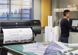
Go Wide
While you were waiting for your legacy plotter to respond, wide-format output technology quietly evolved to provide substantial productivity gains and superior quality. When you consider the state of legacy plotters and printers, think about all the time, not to mention frustration, you’ve spent waiting for files to upload to plotters, lengthy plot cycles (especially for...
Compass Data
CASE STUDY CompassData Ground Control Ensures Accuracy of Digital Aviation Maps Aviation mapping is rapidly transitioning from paper to digital, and CompassData is working hard to ensure the new maps are better than their predecessors. In just the past two years, CompassData crews have collected high-accuracy, globally consistent ground control points (GCPs) and generated satellite-derived orthoimages...
Measuring Form and Function
By K. Olaf Niemann The Hyperspectral-Lidar Research Group at the University of Victoria uses multisensor airborne remote sensing for vegetation mapping. Advances in sensor technology have, in recent years, allowed the remote sensing community the luxury of simultaneously acquiring data from complementary acquisition systems. We now have the ability to characterize a surface in terms...
Advertisement