Category Archives: Aerial/UAS
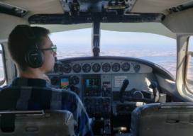
Making Aerial Lidar Work for Small Businesses
Aerial lidar’s growth has created challenges for small business in the aerial-data collection data; here’s how one company turned them into opportunities. Featured image: Midwest Aerial’s main lidar-flying aircraft. For several decades (1950s -1980s), the commercial mapping industry operated in a relatively stable technology environment. While numerous and important technological advances were made (most notably...
The State of MAPPS in 2020
When I became president of MAPPS (a prominent national association of geospatial firms), I had two goals. First, I wanted to increase member engagement. Second, I didn’t want to work as hard as my predecessor. The two goals are not mutually exclusive. In fact, achieving the first goal makes reaching the second goal much easier....

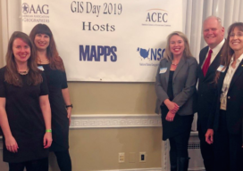
MAPPS on Capitol Hill: A 2020 Update
By John Copple, Ed Kunz, and Stefan Bailey Wow, Washington, D.C. was an incredibly dynamic place this past year. Despite a complex and polarizing political environment, MAPPS made significant progress on many priority issues. The MAPPS Legislative Affairs Committee (LAC), along with many strategic association partners, made huge contributions to our profession in 2019....

Teaching Roots and Research at the University of the Philippines
One of Southeast Asia’s oldest surveying schools is promoting the use of geospatial technologies and thriving in the digital age. When Louie Balicanta walks inside the high-ceilinged corridors of Malcolm Hall on his way to teach land surveying, he knows how much responsibility rests on his shoulders. Not only is he an assistant professor at...
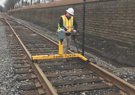
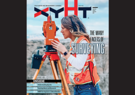
The Many Facets (and Faces) of Surveying
Surveyors have traditionally done a variety of essential and interesting work—and they continue to do so. We’ve asked surveyors from various work disciplines what inspires them. To get an idea of where we are going, it’s important to stop and take a look at where we have been. This rings especially true for those of...
Another Curveball: Coronavirus and Geospatial
Out of the blue, we’re facing another curveball. The current global concern (COVID-19, aka the Coronavirus) was generally not anticipated, and the situation changes daily. It was hoped that, by the time this is published, the situation would have calmed dramatically—but sadly it has taken a turn for the worse. Thus far disruptions have only...