Surveyors have traditionally done a variety of essential and interesting work—and they continue to do so. We’ve asked surveyors from various work disciplines what inspires them.
To get an idea of where we are going, it’s important to stop and take a look at where we have been. This rings especially true for those of us who have chosen to be professional land surveyors and geospatial engineers. We’ve historically done a wide variety of work, and, if anything, that variety is growing.
“Backsighting,” for the uninitiated, is the act of referencing a known object or point to determine the position of other points and features moving forward. For this article I’ve interviewed surveying practitioners across the world, and in multiple disciplines, with the goal of getting a good “backsight” on our profession, and to encourage those considering entering our profession or just starting out to look at what brings us together.
This is an exciting time to be a part of this profession and related industries, as we are all standing in the face of a giant momentum shift. There is seemingly more and more opportunity available to those who choose to practice in our beloved profession. While overall that presents great opportunity, conversely it may be overwhelming to some just starting off, unsure what steps to take.
With the growth of digital media there have been much more outreach and interest in our profession. Whether this is due to the intrigue of drones, other autonomous vehicles, lidar, 3D gaming, or modeling platforms like Blender, more people are beginning to take a deeper look into one of the oldest professions and bring new life to it.
I asked one or more of the following questions to each surveying practitioner, and their answers are based on these.
- What attracted you to surveying, and when did you begin your career?
- How did you get into your current type of work, and what are key aspects you like about this type of surveying?
- What are your biggest challenges, currently, and what are the most exciting aspects of our profession?
- Would you recommend this type of work to young people considering careers? What are your thoughts about the current state of the profession?
- Given the amount of new/added technology available to us, how has that changed your day-to-day work?
- When you hear of new processes being utilized, how long before you consider testing them in your work routine?
- How do you see the profession changing in the next 10 years?
- The following is a digest of responses from a long list of surveyors I contacted. You can read their extended answers online, and we will provide more responses from other surveyors in various disciples in future print issues.
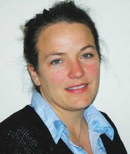
Farrah Etcheverry
A boundary surveyor in Arizona followed family footsteps and has expanded services into mapping and more.

I honestly did have much choice in becoming a surveyor! I was born into the world of a small, privately owned firm and was immersed in all kinds of surveying, ranging from boundary retracement and drone topography to big construction layout. I love it all.
My father, Martin, is an RLS. Since I was young, I have been exposed to bits and pieces of what he did for a living. As I got older, I became more interested in the mapping portion of his work in particular. Once I started working with him, both in the office and in the field, there was no turning back!
I started my career five years ago, in 2015, in the beautiful sunny state of Arizona.
The current state of land surveying is a hot topic right now amongst many of us. The seasoned surveyors are getting older and looking toward retirement, spending a lot of their time trying to find someone willing to commit to a fruitful mentorship.
The young people who are looking at land surveying as a potential career choice are few and far between; pair that with the increase in technology both in the office and the field, and smaller crews are being utilized for larger jobs then even five to ten years ago.
This is part of the reason that intensive training is simply not happening in the capacity that it used to. New guys coming onto the scene aren’t getting enough training and are being thrown in with the wolves before they are truly prepared, all for the sake of time, money, and “efficiency.”
The state of the surveying profession as it stands has so much potential. We need to capitalize on the importance of making solid mentorship and education accessible to anyone and everyone who’s interested in becoming a land surveyor.
The biggest challenge for me currently, and thankfully, is keeping up with the demand in our area. Don’t get me wrong, there are certainly times when business is slow, but right now with our small crew of about four employees we are working literally day and night to keep on top of our workload.
For me, the most exciting aspect of land surveying is the freedom that it gives. Being a land surveyor allows me to travel, to be outdoors, and to hike to places that I would have never otherwise seen. I often liken it to a daily treasure hunt.
Surveying is never, ever the same; it’s new every single day. It’s like solving new puzzles all the time, and the most rewarding part is seeing every piece come together in the form of a map or other type of deliverable.
And the technology is a blast. How many people get to fly drones and used high-powered scanners, GPS, and robotic instruments on a daily basis?
The most challenging aspects of land surveying, for me, often lie in running a business. Surveying can be a high-stress yet very rewarding job; however. the parts of running a company, keeping up with billing, phone calls, emails, insurance, websites, etc.—all of these things are important, but they aren’t necessarily fun for the small-business owner. It can be a big challenge not only to do the physical jobs that keep the business afloat, but also to carve out time to maintain the back-office side of things.
I think the reason most surveyors enjoy the job so much is specifically because it is challenging. It requires focus, dedication, research, physical ability, mental wherewithal, common sense, and computer smarts. You have to be able to troubleshoot, think on your feet, and adapt to any situation thrown at you on the spot.
All of these things could be considered “challenges,” but I would rather classify them as the attributes that describe what we do.
Our workflow has changed as technology has advanced. Over just the span of a few years we have gone from spending hours in the field working on large topographic surveys to cutting field time in half and increasing hours in the office processing massive amounts of data, huge point clouds, and 3D models. Updates and advancements with GPS have made it possible to cover a lot more ground quicker and to get under more obstructions than ever before, so in that way we have become more time efficient when out in the field.
I try to keep apprised of all the new technology and upcoming work flows and processes; however, we aren’t typically quick to jump on every bandwagon. Sometimes the “older” ways still prove to be more efficient for us. Thank goodness for free trials and temporary access codes that allow us to “try before we buy.”
Over the next 10 years I see the use of major technology being the focal point of most firms. I see drone surveying becoming an even larger enterprise than it already is. I hope to see lots of seasoned professionals learning and enjoying these new forms of workflow from the youngsters, and the younger folks being ready and willing to not only learn, but to hold true to the foundational surveying principles that have been laid out and taught for centuries, as well.
Monica Parada
The chief cadastral surveyor for the province of Córdoba in Argentina compares disciplines.
I received my degree in 1997, but at first I didn’t work as a land surveyor, I started in mechanical engineering. Years later, I turned to land surveying—I am really happy with my choice.
My family moved to the U.S. in 2001, and my first job related to my profession was in a large real estate company in California. They used to sell land at public auctions, and part of my duties was to make sure all the information regarding the parcels to be sold was precise and accurate (location, dimensions, maps, deeds).
It was hard at the beginning (I was used to the metric system), and the way legal documents are written in the U.S. is different from in Argentina. But I got an excellent start there and I took courses and invested myself.
I began studying mechanical engineering. Then, at age 25, I paused my studies to follow my husband (an electrical engineer) who got a job in the oil business in southern Argentina. Back in my hometown years later, I decided that mechanical engineering was not a good fit for me, and I turned to land surveying, and I am really happy with my choice.
In Argentina we don’t have a degree in geospatial engineering; the engineering classes in a land surveying degree cover most of the topics of that subject. We have many land surveyors who are GIS specialists or experts in high-tech equipment, advanced computer software, and measurement sciences. They collect data to perform spatial visualization to understand the physical layout or map of a project.
In land-surveying engineering, we cover subjects like legal aspects of land surveying, GIS, astronomy, topometry, and many more, giving us the knowledge to perform a wide variety of work.
I know about geospatial engineering, and I can say that land surveying and geomatics engineering are similar, but in them you work different jobs in the field of land management, because only a land surveyor can validate legal land survey documents. When the land surveyor signs and stamps the documents and builds trust, all information is accurate and legally compliant. The common point between both is the exponential growth that GIS has gone through.
An important challenge in my day-to-day work is the implementation of digital processes. At my workplace there is a clear directive to eliminate paper, and documents are remotely handled via the Directorate website, so I need to be prepared to handle my workload in an efficient and timely manner.
I think our profession will be updated with all the technology and also the possibility of working in a large variety of fields within surveying. At least in Argentina, where qualified surveyors are a small group, we are really appreciated.
We must not fall far behind in technology. Most of my office work is related to legal issues, and, being the only technician in a legal office working among attorneys and notaries, my knowledge of legal aspects must be very good, and I am constantly taking courses in this subject. At college we have been given an excellent background about legal aspects of land surveying.
In the U.S. when I worked for the real estate company I’ve mentioned above, I found no more room for personal and professional development, so I left the company and went to a reputed consulting firm. I felt very happy in the private sector.
Back in Argentina, I did not have the necessary capital to establish my own company, and (sorry to say) women are underpaid. I found an opening in the General Directorate of Cadaster (Bureau of Land Management) and applied; after interviews I got the job and I am still there, where I hold the position of chief cadastral surveyor.
I am eager to learn and test new processes and technologies, but I must note that I work for the government. Administrative processes in the public sector in Argentina move at glacial speed, so it is extremely difficult to acquire new technology or to modify established procedures.
I believe that our profession, as one of the oldest in the world, has been evolving in a spectacular way, including that today the challenges to be overcome are more complicated and sophisticated. I believe that we will continue advancing at the pace set by new technological innovations in every field where surveying is applied. Surveyors were—are—and will be indispensable for our society.
John Hamilton, PLS
A surveyor finds adventure in monitoring, geodesy, and engineering.
In between various stints at college, I was working as a paralegal at a law firm; in 1981 I was offered a position as a survey tech with the U.S. Army Corps of Engineers. Because I was a big fan of the outdoors, I felt that was a better job to have than being in a law office. This led me to switch to civil engineering as a major.
I graduated from Purdue University with a BSCE degree with a major in geodesy right at the time that GPS was first becoming a useful tool for surveyors. I made the decision to specialize in high-accuracy engineering surveys and geodetic control, which proved to be a good fit for my background. Also, learning to write software has enabled me to become much more efficient in the office compared to other surveyors and is something I use on a daily basis.
I believe surveying needs to be elevated to the same level as other branches of engineering with the same education requirements. I also believe there are really two types of surveyors: cadastral surveyors (i.e. boundary and property) and engineering surveyors. The licensing of surveyors should reflect this. If one wants to be licensed in both fields, that would be fine as well. Too many good surveyors are excluded from licensing because they do not practice boundary surveying.
To me, the biggest challenge is meeting client requirements for insurance and complying with contract requirements that have nothing to do with the work being performed.
Surveying is a constantly changing field, with new technologies coming regularly that improve productivity and open new opportunities for surveyors.
I like to keep up with changes and am constantly testing new methods, equipment, and software. Going from two- to three-hour static GNSS surveys in the mid ‘80s to fast static surveys in the ‘90s to VRS/RTK surveys now has certainly changed the methods we use in the field and greatly increased productivity.
As autonomous positioning becomes more accurate, I see the potential for misuse of coordinates and maps only increasing. It will become necessary for the surveyor of the future to become an expert in datums and mapping in general.
Also, the exponential increase in data availability will require us to become experts in not only data collection but also data manipulation and storage, as well.
Olena Avdiienko
A young surveyor in Ukraine finds a career inroad construction surveying.
I performed topographic surveys at the beginning of my career. This process was not easy for me given the fact that I did not have any related education or experience; I was attracted to the profession because of the ability to travel to different regions of the country.
I initially got a job offer in the field of road construction. It was a new experience for me in this type of surveying.
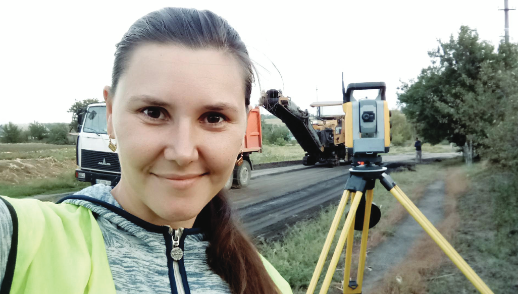
I like it when projects for major road repairs correspond to reality. We have problems with this in our country; designers sometimes use old topographic surveys, and after checking the project I must redo it. This leads to a lag in the work schedule.
I recommend surveying to young people who have a technical mindset, mathematical abilities, and mindfulness. In addition, training and good physical preparation are very important, as the surveyor spends a lot of time in the field. Then they will love their work and enjoy the work process.
Jake Fabian
Working in a multi-discipline firm involves following the footsteps and the leaps and bounds of surveying evolution.
My land-surveying career began with my first internship, during the summer of 2016. I worked in the transportation department at a smaller municipality, helping with everything from level loops to design-oriented topographic surveys and drafting.
I discovered surveying through school. I was taking part-time classes as a nontraditional student, initially looking at an engineering degree. I eventually wanted to find a way to combine my love of the outdoors with the mathematical abilities I was developing; surveying was recommended to me.
I arranged to take an introductory course through a local program and really enjoyed myself. Following that, I planned a transfer into a four-year surveying program. I interviewed and had employment at Westwood waiting immediately after graduating.
I had a strong interest in cadastral work but also wanted to fill out my experience base in other surveying specialties. This led me to look at larger firms spread out across many fields. I also wanted to find a way to support renewable energy development. After putting all that together, my interest was piqued with Westwood. Ultimately, I get a wide variety of work on any given project, with a healthy focus on boundary. From breaking down PLSS sections, ALTAs, traversing through woods or city high-rises, to laser scanning and construction staking, any given day can be different in content and setting.
Most folks seem to agree that surveying is in a state of flux. Technology and methods for collecting and managing data, along with an increasingly diverse career landscape, are merging with the time-tested practices of measuring the land.
The biggest challenges to the profession are staffing and training (mentoring), equally. The profession undoubtedly needs people aware of and interested in it. Moreover, it is crucial that those who do discover the career know what is going on behind the keystrokes that they’ll be making every day. The conveniences of today’s tools can cram a great deal of science behind a button-push.
We also must stay true to “following in the footsteps” while still working in the leaps and bounds that modern equipment and computing allow us.
The most exciting aspect of the profession for me is dealing with living history, working back through time and then bringing something into my era, perhaps in a new light.
I’ve had a relatively short amount of time to see technological shifts, particularly from a field perspective. However, in that time I’ve seen the ability to collect, fuse, and process data from an array of sources become faster and much more user friendly.
I do always try to be mindful of marketing, in lieu of real-world results and ROI. With that in mind, innovation is certainly helped along by exploring workflows, and I’m always willing to try something new.
So much of our society is becoming continually reliant on “where” and “when.” Combining that demand with all the available means to complete a survey, along with data loss rapidly becoming a concept of the past, leads to some really exciting possibilities.
Most importantly—whether that data is used to form a smart city, retrace an original survey, build a chain of title, or develop a site within a virtual environment, etc.—it will still require professional-level evaluation and ethical conduct. In that respect, I see the role of the land surveyor changing very little when compared to the tools that they’ll be using to do the job.
 Caroline Bradley

A geology and earth sciences major with a fascination for the ocean found path to hydrographic surveying.
I began my career in May 2018 when I contracted as a data processor for TerraSond throughout Alaska.
Through my geology degree at the College of Charleston, I met the wonderful Doc Leslie Sautter who runs a program called BEAMS (BEnthic Acoustic Mapping). BEAMS is where undergraduates are able to take a SeaMap course in which they learn how to process bathymetric data.
This course is then followed by an individual hydrographic research project that is based on the data they processed. Both courses allow students to process bathymetric data and show how data is applied to real life. The knowledge I gained from these courses introduced me to the hydrographic field and led me on this career path.
Originally, I was just curious as to where this profession could take me. With the field being as small as it is and staffing being an issue, I was excited to travel and learn more about new marine environments. I grew up on the beach in South Jersey and have always had a fascination with the ocean. This career path immediately attracted me because it allows me to be on the water and learn more about what is going on below.
I’ve been very fortunate early on in my career to be involved in surveys with wide-ranging job scopes, such as maintenance of bridges, foundation work for pipelines, or characterizing seafloor composition to determine fishing rights. The fact that each job site is new is very exciting to me.
The geospatial engineering/land surveying professions are continuing to do great work and are still a vital part of the survey realm. We will always need maintenance surveys along with new design/remodeling projects, so I don’t see the current state of the field being greatly affected.
But, as a 50+ yr geologist whom I meet in the Anchorage airport once told me, “Good thing you chose marine geology, because we’ve mapped everything up here already.”
With that all being said, I am no expert in the current state of geospatial engineering/land surveying, but I believe they will be just fine. It may not be as booming a field like ours, but there will always be a need for their skills.
The biggest challenge for our field is training and staffing. The hydrographic field is still fairly unknown, and training is limited to a couple universities, or it’s very expensive if you seek out training on your own. In both my offshore and inshore job experiences, it seems like trained people are always in demand.
The most exciting aspect of our profession, in my opinion, is that that every new project is its own puzzle, no matter the job scope. You could be a hydrographer who only does dredge work or be a hydrographer involved in a multitude of different survey disciplines, but with each new job site comes new challenges. It is exciting to figure out how to survey a new area and collect the best quality data for your client.
The most challenging aspect of our profession, in my opinion, would be troubleshooting. There are multiple systems at play when you survey, so making sure all systems are a go, communicating properly, and collecting the best data can definitely impose challenges. Also, with the nature of troubleshooting not necessarily being something you can teach in a classroom, it takes field experience and the knowledge of your systems to come to a solution. You hope a problem can be solved within five minutes. However (not to speak for the rest of the field), I think we would all agree that the troubleshooting usually takes longer.
With being fairly new to the field, I have absolutely taken for granted all the sophisticated technologies that make my day-to-day easier than times before. However, I’ve been told how projects were competed before my time and can only image the ease that these new technologies have had on the day-to-day life of more experienced hydrographers. I am excited to see these technologies continue to evolve and experience the change myself.
I am always open to new technology and would feel comfortable incorporating them into my everyday work routine relatively soon. Of course, I would want to see these advances perform in sea trials along with taking a look at the data they can produce, but if these factors are all beneficial to my day-to-day, I would hope I could acquire the technology quickly.
When I think about where this field will be in the next 10 years, I think there will be a greater shift to drone work. With technologies like ROVs, Z-boat, etc. evolving, I can see the field moving towards this path. I just saw an article about Ocean Infinity’s new robotic vessel fleet, called the Armada, and it is these kinds of capabilities that are exactly the kind of evolution our field is heading towards.
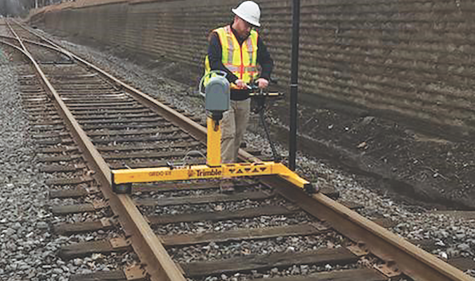
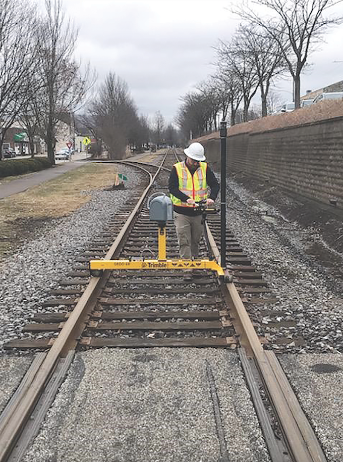
Adam Zweig
A railroad surveyor is keeping an eye on advances.
I began my career the summer of 1997 in south Florida. My stepfather is a surveyor, and while growing up I helped him out occasionally and decided to go for it full time.
A majority of the firms I have worked for have been heavy in the construction field, so that has been my background until the last eight years. I started doing construction work for a few railroads while working for a consultant and found that I really enjoyed the railroad work. An opportunity came up for me to work directly for a railroad, and I made that move.
I think it is a great time to be a surveyor with all the advances in technology and new and innovative products and software. Some of the tools and solutions we use today I couldn’t even imagine being around when I first started.
We do not have these issues where I currently work, but I could see staffing becoming a challenge. I think with the advancements in technology, like machine control, the typical entry-level positions are going away.
 For me the most exciting aspect is the ever-changing and improving technologies, and that’s the most challenging aspect. If you don’t keep up with the latest hardware and software, it will pass you by. Especially with software, the look and feel of the interface is constantly changing and improving. It’s hard to keep up with these updates and improvements if you don’t keep up to date with the releases.
The equipment we use to locate the rail now allows us to do so with more accuracy as it relates to the locations of key horizontal and vertical geometry points. We are able to exponentially gather more data in a much shorter time frame. If a product fits in our workflow and we can see a benefit, we move very quickly to test new products.
In the next 10 years I expect to see a lot more automation in everyday work.
Christof Lambrecht
A Belgian engineering surveyor reflects on the digital transformation of the profession.
I started as a surveyor trainee in 1986 and became a professional land surveyor in 1989, licensed since 2005. (Licensing was introduced in Belgium in 2004.)
I started mainly on construction sites in the heavy steel industry, but I also worked on pipeline as-built surveys and deformation of tanks in the petrochemical industry.
In 1990 I changed to another engineering firm and did more topo surveys for infrastructure. For the first 20 years I did nearly 90% fieldwork on roads, subdivisions, industrial development sites, and sewer systems for small and large cities. Ten years ago I switched to a 50% field and 50% office job as survey manager and as-built coordinator. Since 2015, I do almost 100% of my work in the office: organization of survey-related field and office work, keeping an eye on calibrations, coaching the new members in the survey team, etc.
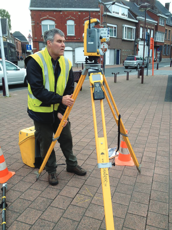
Working at a large engineering company lets me work on larger infrastructure projects. For design we start with the fieldwork to survey the existing conditions, followed by boundary research to add the right of ways and the available public domain. Once the project goes into the construction phase, we stake the right of way, do the design, and check if what is built conforms to the design. We also survey or check the as-builts for sewers and storm drains. That may span a period of some years between starting the survey for design and approving the as-built survey. If all goes well, this takes about three years; if expropriations come into play that may be ten years.
It’s great to be part of the different processes of constructing new infrastructures.
Currently there are great opportunities in the profession; technology is changing at a high rate. There’s a lot to learn about new equipment, software, online-resources, etc.
New sensors let us capture the outside existing conditions’ reality much faster, so field time is reduced while office time increases, but not everyone is interested in more office time! All the scanning and imaging tools have their limitations; it takes time to get the engineers and designers comfortable with point clouds.
Do we achieve the accuracy we need? With the objects that are not in view due to canopy, trees, trucks and cars blocking the sight of the scanner, we still need a surveyor on site to take shots on what’s missing. Bottoms and levels of ditches and canals and types of marker stones for underground utilities are hard to distinguish in scans or photos.
I have the feeling that the art of surveying—traversing, connecting the dots with field coding—is disappearing. To set up and operate a scanner, you don’t always need the knowledge of a surveyor anymore.The biggest challenge for me is that training young people was a lot easier year years ago when we had two-person crews. It’s also hard to keep up with the changing regulations and ever-changing laws in Belgium, for expropriations and community roads for example.The most exciting aspect of our profession is that our profession has so many aspects. You have the technical skills and the high-tech instruments, sometimes the hard labor of the fieldwork, and the historical aspect of delving in the ancient cadastral sketches and notes from the surveyors 150 years ago to retrace the boundaries. Don’t forget a good portion of law about boundaries and properties. Sometimes you can work five days in a week and do five completely different jobs, all on the same project.
Another positive aspect of my job is that I meet a lot of people. At the office of a large engineering company, the land surveyors are part of the infra-division, so there we already have contact with the engineers and designers, but we have also jobs with colleagues in the environment and building division. ARCADIS operates worldwide, so I also have frequent contact with the land surveyors from North America, the UK, and the Netherlands, where we discuss and learn from each other about H&S, quality management, equipment, software, new techniques, etc.
Then there’s the contact with the owners and the people on our jobsites, which is in 90% of our jobs: public domain, existing roads, and the related boundary research.
The most challenging aspect of our profession is efficiency: choosing the right people and tools for the job and making sure everyone is well trained for the job.
Over the years we have moved to a complete digital process. The only paper notes we still have are for taking inverts in manholes, and we’re looking at automating that process as well.
We still talk about teams, but for the past 10 years for regular work we use a one-person team with GNSS and total stations. The only times we’re out with two or three people is for the inverts on manholes.
I have always been interested in looking for a workflow to get the most results from the fieldwork. We fine-tuned and customized our F2F coding system so we get maximum results in the field with minimal key entries no matter if we have to deliver DWG or native DGN.
In the next 10 years I believe more scanning, lidar, and SLAM tools will make their way to the field. So, field time will be further reduced, and we will need more processing power at the office. It has been this way ever since the personal computer was introduced.
 Dominica Van Koten

The new Washington, D.C. chief cadastral surveyor for the Bureau of Land Management emphasizes stewardship.
I began my career with the Bureau of Land Management (BLM) Alaska State Office in 1991 as an intern working summers while attending Ferris State University.
First, I enrolled in a drafting course during high school. I enjoyed it so much I signed up for a second year and became a tutor for other classmates. My teacher, Mr. Frank, once mentioned he thought I would make a good surveyor because of my drafting skills.
I knew I wanted to go to college; however, I had no idea what I wanted to be. I decided to apply at Ferris State University and was required to select a major on the application. While perusing the list of programs offered there, I saw surveying and decided I would give it a try. I was accepted in the program and completed my degree four years later.
When I learned about the history of the public land surveying system in my legal aspects of surveying course, I knew I wanted to be part of the BLM surveying team. I have worked as a surveyor for the BLM since 1991.
The BLM is the successor agency to the General Land Office (GLO). The GLO was the federal organization responsible for the original survey and disposal of the United States public domain lands. In addition to performing federal authority surveys on federal interest lands, the program also manages the large collection of government patent records and the land federal land status system.
The most exciting part of my position is researching original records to follow in the footsteps of the original surveyors and land office staff to assemble the current land status of a parcel. I have learned each parcel has its own story not only of where it is located but also of those individuals or organizations who lived or worked there.
The land surveying profession is one of the most exciting careers to pursue. The broad range of career possibilities and the diverse use of high-tech tools appeal to many individuals. In addition, so many industries depend on knowing the location of their land and resources. I recommend the surveying profession to anyone interested in math, science, technology, and history.
I think one of the biggest challenges for surveying is bringing new people into the profession. There are more jobs in the surveying field than there are graduates of surveying programs. We need to find methods to communicate our story and the opportunities in the surveying profession that excite high school and junior high school students.
One of the biggest challenges I am aware of is transitioning to a fully digital land tenure and surveying system. The BLM has more than 200 years of paper surveying and title records in our custody. We have been successful at transitioning portions of the process to a digital environment; however, there are still key parts of the process that are manual.
It is difficult for me to single out technology as a factor of how my workday has changed because my role also changed from a field surveyor to an office surveyor then to a manager. I keep an open mind about using new tools to accomplish our mission and communicate efficiently.
I expect the profession will continue exploring new technology and tools for fieldwork and records stewardship in order to support land ownership and title in the United States.
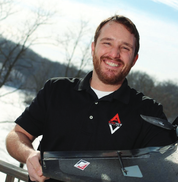
Zach Pieper
A surveyor with roots in the land likes the variety that the mainstreaming of UAS has brought to the surveying.
I grew up on a farm in Iowa, so work started as soon as I could wrap my hands around a wrench or hold a grade rod up. We did all of our own field grading and drainage. That’s where I got my first taste of surveying, holding the grade rod while my dad checked grade with a transit. I found out the guy with the grade rod does all of the walking.
My “professional” career started in 2003 with Caterpillar’s Marketing Training Program in Peoria, Illinois.
My business partners and I saw an opportunity open up when the FAA allowed 333 exemptions for commercial drone operations. Once we had our 333 in hand, we were off and running, offering drone flights and data processing to, at first, civil engineering firms.
I love variety. Being a service provider, not in an industry-specific engineering or surveying firm, I enjoy the variety in the work we do for our clients. One day we could be building a bare earth surface from drone lidar for a new force main project. The next, it could be infrared images for a roof leak inspection at a large manufacturer or even drawing planimetrics from a drone flight for a waterpark several states away.
Like all of the STEM professions, there is a lot of opportunity for geospatial, but we need to expose more young people to our corner of the industry. Many of the new survey tools and software lends themselves to a much wider range of applications than most people realize. I think there is a lot of opportunity to broaden the definition of what we do, expanding our potential workforce.
I’d say our challenges are typical of any growing service provider: managing growth, staff training, marketing, etc. There is never a crystal-clear remedy for any of them. We just need to manage our challenges the best we can for each stage of our business.
I really enjoy all of the new technology and figuring out how to integrate it into existing workflows. A shiny new toy (I mean, tool) is not much good if you can’t get it to work in conjunction with the rest of your tool kit. No instrument or software works alone anymore.
The most challenging aspect is time management. It is easy to get lost in the amount of data that is collected.
We watch the horizon closely for new tech. Sometimes it is clear that it will be a few years before it is cost-effective for our clients. If the value is clear, we jump right into figuring it out.
I think surveyors and geospatial professionals will become a more important part of every project. With all the tools available now (with more coming!) it will take an experienced and up-to-date pro to decide which one is the best choice for each part of the project. For a surveyor, it’s not just robot and/or GPS anymore.