One of Southeast Asia’s oldest surveying schools is promoting the use of geospatial technologies and thriving in the digital age.
When Louie Balicanta walks inside the high-ceilinged corridors of Malcolm Hall on his way to teach land surveying, he knows how much responsibility rests on his shoulders. Not only is he an assistant professor at the Department of Geodetic Engineering of the University of the Philippines, but Balicanta is also its current chairperson, managing 400 students and two dozen faculty members in this 83-year-old learning institution.
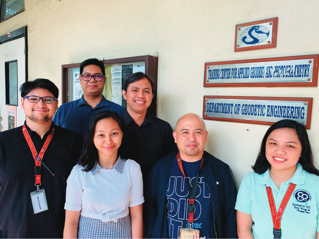
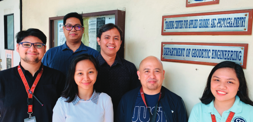
Members of the Geodetic Engineering Department.
“Our vision in the department is to be recognized as a global geomatics engineering institution,” shares Balicanta with pride. He is a geodetic engineer and holds a master’s degree in urban planning. “We aim to continually improve our resources—and that includes our faculty, non-teaching staff, and facilities—so that we can better serve our society.”
The department’s beginnings coincided with a time when new lands in the Philippines were being opened. In 1925, it started as a training school for surveying that offered a two-year associate course during the American colonial period.
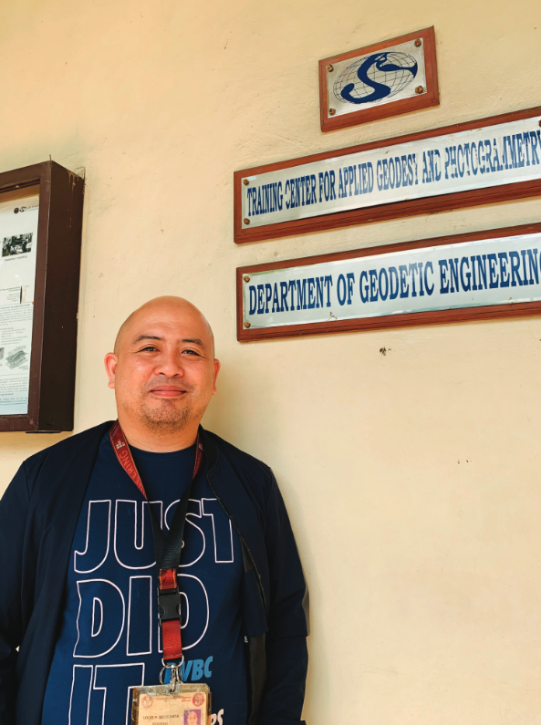
Engineer Louie Balicanta is chairperson of the Geodetic Engineering Department.
“Land surveying was one of the initial aims of the establishment of the surveying school,” Balicanta says. Professors were trained in the U.S., and they came back to teach in the country. “Scholarships were provided by the American government so that graduates would be later employed by the Bureau of Lands as surveyors,” he adds.
In 1937, the four-year geodetic engineering curriculum was officially introduced, succeeding the original two-year surveying course. Decades later, in 1964, the Training Center for Applied Geodesy and Photogrammetry was established.
“This truly paved the way for the department to do geodetic training, research, and extension,” says Balicanta.
Now, not only is the Geodetic Engineering Department one of Southeast Asia’s oldest existing surveying schools, it is also leading the way in the Philippines and in the Asian region to promote the use of geospatial technologies in and outside of the classroom. Its graduates are recognized for their skills and can be found working around the world. Even xyHt magazine’s prestigious annual 40 under 40 award has taken notice: since 2017, five of the department’s former students are laureates.
What makes this feat striking for an octogenarian surveying institution is that the department has achieved all this despite the usual financial challenges that beset most public universities.
What’s their winning formula? I talked to five professors to learn more about how they keep their academic program relevant in the geospatial digital age. Here are my takeaways.
Adaptive Approach to Learning
With the rapid evolution of technology, universities must make sure that their academic programs are focused on developing the capabilities of their students. Doing so guarantees that they can meet the current and future needs of the communities that they serve.
“Geodetic engineering education is influenced by the fast-changing technology; thus there is a need for us educators to provide strategies to cope with this rapid change,” says Balicanta. “To make our academic program relevant to the changing needs of the modern times, our curriculum undergoes revision every five years.”
He then shares something noteworthy that other institutions might learn from: “When we revise the curriculum, it includes consulting with industry stakeholders through networking.”
Another important part of the learning process is the ability of teachers to teach. I talked to John Louie Fabila, lecturer of geodesy and one of this year’s xyHt 40 under 40 professionals, and he shared with me his teaching approach.
“I try to balance between teaching theories and hands-on activities,” Fabila says. “Bombard students with just theories and you lose them early on. So, I try to first provide easy practical activities to get the students hooked on the topic, then later I inject the theories, and afterwards I allow them to do intensive activities that require more critical thinking.”
Known for giving witty lectures, Fabila shares that he is still learning how to become an effective educator. “I guess what works for me is contextualization and humor. Teaching theories in isolation rarely works, so I try to connect it to something tangible like its practical use and its importance in the industry,” he says.
“I then add humor because it diffuses the monotony of being in the classroom. If I made you smile a bit and roll your eyes over the silliest jokes, that means you’re still listening to my lecture, right?” he says with a big grin.
Ariel Blanco, professor of GIS and one of xyHt’s 40 under 40 honorable mentions in 2017, has a different teaching approach.
“I would like my students to be lifelong learners,” Blanco says, believing that students learn in different ways and paces. “Over the last 22 years of teaching, my approach has evolved from simply teaching theories and doing practical work to a mix that now combines group discussions, interviews, exploration walk, and online courses.”
Although mixing learning techniques may work for some, Jak Sarmiento, who teaches graduate courses on geodesy and GNSS, believes that similar attention should be given to the basics. “I’m going against the general trend of an applications-based teaching so I intentionally focus on strengthening the students’ scientific fundamentals.”
Engineer Jak Sarmiento teaches graduate courses on geodesy and GNSS. Below: Students operate a total station for their surveying class.
Sarmiento believes that it is important for students to be fundamentally grounded. “Everybody can learn to manipulate a software, but not everyone can understand the theories behind the knowledge built by the pioneering men and women of geodesy.”
The same holds true for Erica Elazegui who teaches surveying and mathematical methods. “I always tell my students that our goal in class is to understand the most basic concepts so that when we go further to complex lessons, it would be easier for them. Also, I try to teach them how to be resourceful, practical, and time-efficient through practical activities,” she says.
Like Elazegui, Blanco also believes that more than just teaching and learning new technologies, an effective teacher helps students develop and enhance their character, integrity, and empathy.
“For me, you become an effective educator if you are able to inspire and enable students to apply the geospatial approach and tools. Learning geodetic engineering is geospatial enablement!” he shares.
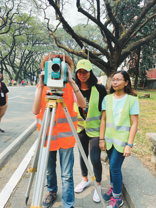
Students operate a total station for their surveying class.
Nurturing Strong Research Collaborations
One of the common themes during my conversations with the professors is the department’s solid research background through local and international collaborations. The University of the Philippines consistently ranks as one of the best in Asia, and it has a strong research tradition. The Geodetic Engineering Department is keeping that tradition alive.
“We have created research groups and laboratories in the last years, and we plan to establish more,” says Blanco, who has been involved in remote sensing and lidar research projects. “One of the most noticeable changes in the department is the strengthening of our research and development capabilities. Also, we have a greater drive to connect with our counterparts in Asia.”
This drive to collaborate with international counterparts has been fruitful. Since 2014, the department has been actively working with Japanese researchers and local institutions in the development of micro and nano satellites, particularly in calibrating their remote sensing payloads and in the processing of geodata.
Three of these satellites have since been launched into space and are now capturing useful geospatial data for the country. Another xyHt 40 under 40 awardee in 2018, Mark Tupas, is involved in these research activities. He leads the design of the data processing, archiving, and distribution sub-system for the ground receiving station of microsatellites.
Balicanta shares that their participation in building satellites is their most important research activity to-date. “The two space-related research projects, the DIWATA and STAMINA4SPACE programs, have provided an opportunity for department to develop microsatellites.”
“We are now involved with the management of the Philippines’ space assets,” adds Sarmiento.
The department is also leading the country in its use of lidar technology to monitor natural resources and natural disasters from space. Just this year, it has released Asia’s first open-access lidar data to aid in reconstruction efforts after the eruption of Taal volcano, one of the world’s smallest active volcanoes.
“The DREAM/PhilLiDAR is the biggest research project in the history of the country,” shares Sarmiento. “I led the lidar data acquisition team which was composed of young engineers and scientists. We accomplished something that many people thought we couldn’t do,” he adds.
However, while most of the research projects are on geomatics, Blanco emphasizes the unique and important role of surveying in these activities. “Be it traditional or modern, we have strong foundations on surveying. This distinguishes our work from other similar projects,” he says.
Keeping Its Roots in Surveying
How does traditional surveying fit in the department’s curriculum as more advanced geospatial techniques become more available?
“Geodetic engineers in the Philippines are the only professionals mandated by our country’s law to do land surveying; thus the department can not and will not forgo teaching traditional surveying topics,” shares Balicanta.
Such is the case that in terms of technical support to professional surveyors in the country, Balicanta says that the department is actively involved in the modernization of the Philippine Geodetic Reference System (PGRS).
“What we do is to introduce new methods using current technology in doing long-standing land survey methods such as location and area determination,” he adds.
Sarmiento maintains that there has not been a change of focus from traditional surveying to current geospatial topics. “Surveying is, and forever will be, our core competency,” he says. “What happened was an expansion of our competencies as we built our research capacities for the past ten years. We don’t sit still.”
Fabila agrees. “I would not say a change of focus away from surveying, but rather an accretion of topics that people are starting to realize what we geodetic engineers can do.”
Yet, the current crop of students seems to be shying away from traditional surveying. Could it be because of the pervading public perception that geodetic engineering is just all about land titling and land surveys?
“This is indeed a challenge in terms of encouraging kids to take up geodetic engineering. We must strengthen our information campaign and be more aggressive in showcasing its relevance to current affairs. Social media works,” shares Sarmiento.
Elazegui agrees. “Most students assume that we only do traditional surveying. They are surprised during our course orientation that we also teach mathematical methods, programming, remote sensing, and GIS,” she adds.
She has also noted that there has been a huge change of focus from traditional surveying to other geospatial topics, especially when students choose their undergraduate thesis topics. “They commonly pick topics under GIS, remote sensing, and photogrammetry,” she says.
Indeed, GIS remains a popular course among students of the department; just ask Marion Ordillano who is on her last year as an undergraduate.
“My favorite subject is GIM 175 or ‘Geographic Information Systems: Theory and Applications.’ Out of all the other major course subjects I have taken, I genuinely enjoyed it a lot. It’s satisfying to see that I can easily make spatial representation of any data,” she shares.
Students seem to get excited when they see the how geodetic engineering encompasses the whole gamut of the spatial data life cycle, from Earth data acquisition, spatial data organization and management, to geoinformation visualization and analyses.
I asked Ordillano what she plans to do after graduating, and her response was positive about her future prospects.
“I see myself working for the government, may it be in projects here in the department or in the country’s National Mapping Agency. But I also want to go abroad, to Australia, and save up for an NGO or a foundation that I want to start,” she says confidently.
Keep Moving Forward
Like most public universities, the department is facing its own challenges in teaching geodetic engineering. “We can go head-to-head in terms of skills with other countries, but we need more classrooms. We need more labs. We need more equipment. We need more faculty positions,” says Sarmiento.
Despite these challenges, he is still hopeful. “We keep moving the game forward. We have the highest number of faculty members with post-graduate degrees in the department’s history, but we need to be able to keep them.”
As for their graduates, Balicanta shares his pride in the quality of geodetic engineers whom they have produced. “We are proud of our graduates. Maybe their competitiveness is brought about by the department’s conscious effort to train our students to be leaders who will provide socially relevant solutions to our country’s problems.”
As I end the interview with Balicanta and the other professors, he tells me that teaching geodetic engineering is really not just about learning how to use technology. “It is important that we must teach our students the principle that any spatially related problem can be solved using geomatics. With this, our graduates can go and do things beyond the more traditional land surveying applications.”

Luisito Pernia is the department’s equipment custodian, shown here with a total station ready for students to use.