Category Archives: Aerial/UAS
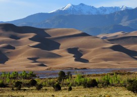
UAS Survey of the Great Sand Dunes
The Great Sand Dunes National Park and Preserve is located in South Central Colorado and contains the tallest dunes in North America, spread across 30 square miles. It is an amazing destination, one that I first visited when I was 18 years old and have re-visited innumerable times since; I simply never tire of its...
Markets for Geospatial 2017: Part 2, Infrastructure
President Trump’s plan for investing in America’s infrastructure calls for $1 trillion in spending over the next ten years. The specifics of the plan are still a work-in-progress, but with largely bipartisan support, chances are that there will be a big push on infrastructure projects in the coming years, and that should translate into significant...

40 Under 40, 2017: Jonathan Downey
FOUNDER AND CEO OF AIRWARE CALIFORNIA, USA AN UP-AND-COMING YOUNG GEOSPATIAL PROFESSIONAL, Jonathan Downey is also prominent in the UAS industry both nationally and internationally. A graduate in electrical engineering and computer science from MIT, Johnathan has served as a commercial pilot, has developed components for motorcycles, and was a software engineer at Boeing, contributing...

Pangaea Looks Back at 2016
Undoubtedly, for me the most notable event of 2016 (in the geospatial world) was the FAA’s Rule 107 allowing sUAS to be used in the NAS for commercial work. No more Section 333 exemptions. (Well, for merely flying, anyway; if you want to go beyond the restrictions of 107, you’ll still need to file for...
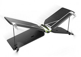
Buying a Drone for the Holidays?
Friends know of my interest in unmanned aerial systems, so they ask me, “What kind of drone should I buy for Christmas?” I probe a little further to define what their “use case” is. It usually boils down to two categories. 1) For the kids: Cheap. If you’re looking for a toy drone to have...
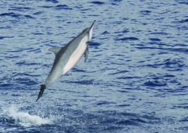
Disparate Data for Marine Life
Remote sensing data helps to inform ocean planning for energy development around the main Hawaiian islands. Using remotely sensed imagery to map physical and biological patterns in the marine environment enhances our ability to understand how environmental conditions change over broad spatial scales (10s to 100s of kilometers) and temporal scales (years to decades). These...