Category Archives: Energy/Utilities
TheGeoDude on The UESI Conference
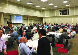
I’ve attended a lot of conferences over the years. They’ve primarily been either surveying-focused or technology- (GPS, laser scanning, reality capture, CAD) focused. The recent Utility Engineering and Surveying Institute (UESI) conference, held April 22 to 24 in Pomona, California, was my first conference with a strong mix of civil engineers and surveyors; a show...

Getting out Is a Good Thing
Field Notes Although I have been active in the surveying profession in several ways over the years, including serving as the editor of Field Notes, I really haven’t ventured out much to seek face-to-face encounters in various venues and settings, but that recently changed a bit and has produced a new perspective for me. In...
Open Source for Enterprise Solutions
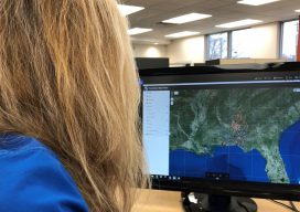
A geospatial firm integrates open-source GIS and cloud services for the DoD’s IT security, a giant energy co-op managing 2,500 miles of transmission lines, and the USACE as they monitor dredging vessels. Too often, clients maintain outdated and inefficient workflows because they fear that building applications to improve processes would be too time-consuming and expensive....
Powerline Inspection
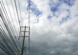
Drone? Ground? Helicopter? For years now drones, UAVs, UASs or whatever you wish to call them have been the revolution that promises to change the way we live. Five+ years into the drone revolution we are seeing some change—but it has certainly been a slower progression than expected. Linewise Aerial specializes in transmission line inspection...
Night in the Afternoon: A US Solar Eclipse
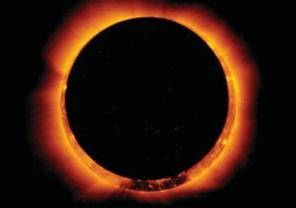
What you need to know about the 2017 solar eclipse The upcoming solar eclipse will leave a 70-mile-wide trail of darkness across the United States on August 21, 2017 (see the map of the eclipse path on pages 44-45). This will be a once-in-a-lifetime event for many people. While another total solar eclipse will make...

GEO Business 2017
Nicholas makes the annual pilgrimage to GEO Business for xyHt This blog is going to start with a short piece about skips. If you are afraid of skips (skips are what you’d call “dumpsters” across the Atlantic), turn away now …. Monday morning and 24 hrs from the start of GEO Business 2017, I get...