Category Archives: Lidar/Imaging

Sensing Improvements? The Future of Lidar & UAVs
By Neil Sandler What does the future of lidar and UAVs look like in our world? We’re preparing this issue of xyHt just as we return from the important International LiDAR and Mapping Forum (ILMF) in Denver. Coincidentally, this issue will be widely distributed at the SPAR 3D conference and expo in Houston this April...
Back to Dinosaur Ridge
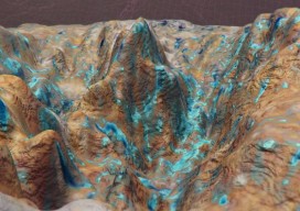
Close-range 3D photogrammetry solves mystery of 100-million-year-old dinosaur tracks. Back in the summer of 2014, I visited Dinosaur Ridge, just west of Denver, Colorado, as part of a demonstration of close-range photogrammetry given by CAE Mining, which uses the technology in its volumetric mine site analysis software. Dinosaur Ridge has become one of the world’s...
Caught Mobile Mapping
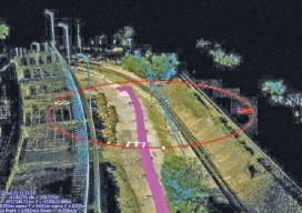
Above: Using a mobile mapping system, Construction CAD Solutions can generate high-accuracy point cloud data–in multiple views, as shown above and at left–to assist in its utility design function. Mobile mapping: A Chicago firm uses lidar innovation to survey for fiber infrastructure–for hundreds of miles. By Larry Trojak The ability to identify, accept, and then...
Deep-sea Mobile Mapping
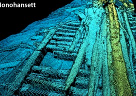
We’re all familiar with lidar-based mobile mapping from ground vehicles, and most of us are aware that aerial lidar is being used effectively to do shallow-water mapping along coastal and riverine projects. Deep-water lidar mobile mapping from an ROV? Well it’s a first for me. Most all of the subsurface surveys I’ve read about were...
Orbit GT & Integration in the Mapping Business
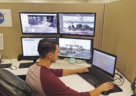
A new software integration tool attacks what I call “workplace technology interplay denial.” Above: At BPG Designs, plenty of screens are filled with integration software. Through our smartphones, we are now integrated with all the people we know (and don’t know); we have integrated our work spaces with our home lives; and we can even...

Market Opportunities for Geospatial in 2017
Construction Prospects, Part One As we start a new year, it seems only fitting to take a look at what 2017 might hold in store for us. Let’s start with construction: a major source of income for the geospatial profession. Dodge Data & Analytics publishes all types of data for the North American commercial and...