Category Archives: Lidar/Imaging

Leveraging Point Clouds
Above: This image illustrates the transition from point clouds to modeled deliverables. These non-BIM solids were later used for com-putational fluid dynamics analysis to ensure proper airflow throughout the room. Three ways you can derive value from point clouds past the pre-design phase. By Daniel Chapek Reality capture is a powerful way to digitize the...
Three Trends at SPAR International 2017
I’ve attended SPAR every year since its inception in 2004, always while working for a vendor for 3D laser scanning products. This year, sporting my new xyHt shirt, I viewed the event from a different perspective. Let me preface this “review” by noting that I did not do a complete walk-around of each vendor’s booth;...

15 Years of Growth at AXIS GeoSpatial
AXIS GeoSpatial provides more applications from one mapping effort. Easton, Maryland-based AXIS GeoSpatial LLC provides geospatial data and solutions to federal, state, and local government agencies and private sector firms, especially aerial mapping services. Heights talked with Erica Insley, marketing director for the firm. Heights: How did AXIS GeoSpatial get its start? Erica Insley: Founded in...
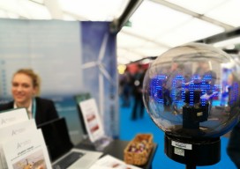
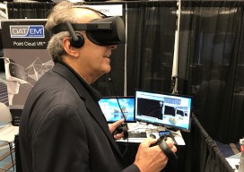
Ocean Business 2017
Last week, April 4th – 6th, one of the largest gatherings for the offshore industry took place, Ocean Business, in Southampton, UK. The bi-annual event is a large deal for the maritime industry. When I say large, I actually mean huge; there are over 350 exhibitors from 26 countries and 166 training and demonstration workshops...
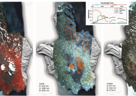
HSI on the Fly
One company details mapping applications of airborne hyperspectral imagery for agriculture, forestry, and resource mapping. By Patrick Burns and Scott Nowicki, PhD Remote sensing imagery has been collected with many different camera systems for many different applications over the past 50 years of the industry. Visible remote sensing imagery provides interpretable information available to most...

Strategic Movement: Precise Monitoring in Practice
A Danish company builds a successful monitoring business by leveraging technology and expertise. By John Stenmark, LS Newton’s laws of motion tell us that nothing moves if it isn’t pushed or pulled. That concept is behind the success of LE34, a Copenhagen-based surveying company that has built a business strategy around structural monitoring for a...