Category Archives: Surveying
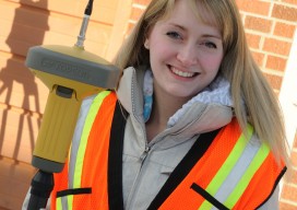
State of: Surveying
Surveying is the timeless science and profession of geographic measurement and boundary determination that has evolved over the centuries, constantly improving with advancements in technology to keep pace with the world around it. One aspect, however, has not and should not change: the fact that surveying is a profession. Per professional licensure and supporting laws,...
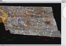
State of: Close-Range Photogrammetry
By definition, close-range photogrammetry (CRP) is simply photogrammetric data collection and processing where the subject is less than 1,000 feet away. Collection methods can be both ground- or aerial-based, and the final output can be rendered either two- or three-dimensionally. Several factors have made this a powerful tool for geospatial professionals. The strongest of these...
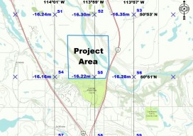
Geoid Model Interpolation Problem
The Canadian federal government recently released the first new vertical datum in 80 years in Canada. The new vertical datum is called the Canadian Geodetic Vertical Datum of 2013 (CGVD2013). The introduction of this new datum not only establishes a more accurate and precise vertical reference system, it also introduces a new methodology for realizing...
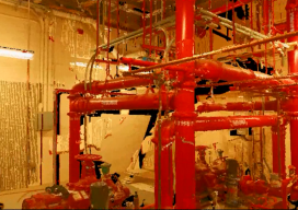
When to Use Laser Scanning
Some clients don’t understand the benefits of point cloud data and how it can be leveraged. At my company I talk to them about how laser scanning might fit the type of project they have as well as the potential cost savings. First and foremost, collecting and using laser point cloud data on your project...
Advertising and Marketing at xyHt
Our Editorial Policy Flatdog Media, Inc. (and xyHt’s editorial team) seek relevant feature and story development ideas from all practitioners in disciplines that use precision measurement, positioning, and imaging technologies and skills. Story ideas submitted by individuals and companies wishing to publish content in the interest of all geospatial professionals will be considered. Please send...