




Top Stories
Get your top stories below

xyHt Weekly News Recap: 05/26/2023
Overture Maps Foundation Names Marc Prioleau Executive Director Phase One Announces iXM-SP150 at GEOINT Trimble Advances Reality Capture with the ...

Spring has Sprung
Field Notes Is there a better profession than being a surveyor–especially in the spring? These are the beautiful days we ...
A Decade of Uncrewed Photogrammetry
Some might have had a peek at photogrammetry drones before 2013, but for me 2023 marks a decade since I ...

Tracking the Paranormal
Mapping Your World Ever wonder where Bigfoot hangs out? What about where most UFOs fly by? Explore both with this ...

How Green Is Your City?
As tree-planting efforts take root in cities around the world, urban managers turn to geospatial tools to map and monitor ...
xyHt Weekly News Recap: 05/12/2023
Phase One Takes Aerial Imagining to Another Level GeoBusiness is Back for 2023 USGIF GEOINT Symposium Set for St. Louis ...
xyHt Weekly News Recap: 05/19/2023
New Ways to Use Drones for Inspections and Quality Control AEM Hall of Fame Seeks to Break More New Ground ...

Autonomous Drone Mapping
How interior spaces like mines are being scanned and imaged by a drone that works without a pilot or connectivity ...
The Advantages of “Built Here”
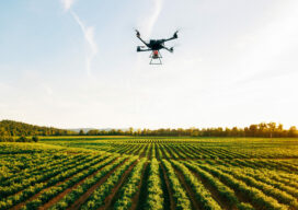
There are reasons other than policy and security to consider domestically produced drones. Yes, when it comes to the drone ...
xyHt Weekly News Recap: 05/05/2023
Leica Geosystems Introduces Pegasus TRK100 Sanborn Pioneers the Digital Twin Base Map Nexar Revolutionizes Map-Making with 40x Reduction in Real-Time Costs ...

Surveying for Safety at Waipio Valley
Lush vegetation, beautiful ocean vistas, and a historic Hawaiian valley provide the setting for a complex engineering project that addresses ...

The Incredible UAV
Looking Forward Land surveyors aren’t just surveyors anymore. Map makers aren’t just cartographers anymore. We are all tied together in ...
