Coordinated Campus Archives
Be Critical of the Data

Image above: The author’s view of Lake Michigan as he walked toward the lighthouse at Manitowoc. Not long ago, obtaining data for a surveying or GIS-based project was an arduous task. Because great time and effort was involved with either creating your own data or obtaining data that someone else created, you had to think […]
GIS Day

From the Coordinated Campus In a rapidly changing field such as geotechnologies, education is an ongoing concern and rightly so: if we are not lifelong learners, we won’t last long in this industry. But I contend that we as geospatial professionals also need to be aware of and provide leadership in larger geospatial education trends […]
GIS in K-12

Above: Middle school students collect macroinvertebrates in Rocky Mountain National Park. The data will be mapped and analyzed using a GIS. Credit: Joseph Kerski. Where did you first learn about GIS? Was it in a course at a university or a community college? Were you an undergraduate or graduate student? Was it at a conference, […]
GIS in Higher Education
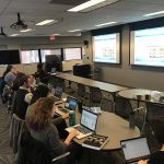
Given this column’s theme of the coordinated campus and educational implications for the GIS professional community, it seems fitting to ask: If you went to a postsecondary school, did you take a course in GIS? For more people than ever before, the answer is “yes.” GIS has long been a part of institutions of higher […]