From the Coordinated Campus
In a rapidly changing field such as geotechnologies, education is an ongoing concern and rightly so: if we are not lifelong learners, we won’t last long in this industry. But I contend that we as geospatial professionals also need to be aware of and provide leadership in larger geospatial education trends and issues.
Hence this new column, “The Coordinated Campus.”
Think of “coordinated” as geographic coordinates and geospatial, but also “coordinated” in that all of the articles in this column will focus on education.
Think of “campus” as including what’s happening in K-12, technical college, and university education around the world; training organized by nonprofit organizations, private industry, and government agencies; and societal and educational forces that affect the geospatial profession.
This column also will include items for you to plan how your own “campus”—your organization and you—can contribute to geospatial education.
Building on the geoliteracy theme as mentioned by my colleague James Boxall and on STEM connections explored by J.B. Byrd, both in previous issues of xyHt, my goal is to help extend your thinking about what encompasses geospatial education and why it is worth pursuing. I look forward to your reactions.
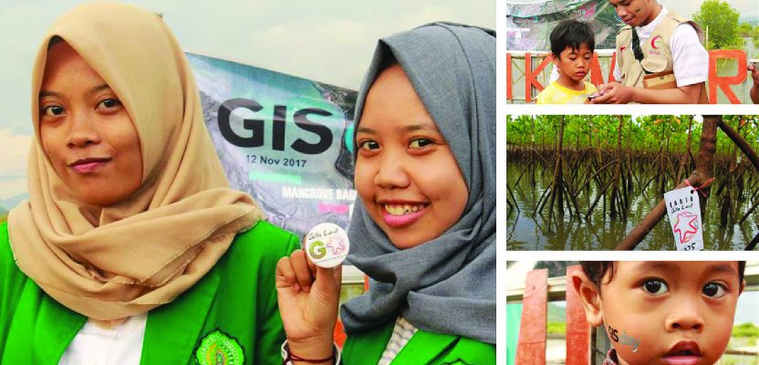
GIS Day Events
In this first installment, let’s discuss a longstanding way in which people learn about geospatial technologies—GIS Day. GIS Day provides an international forum for users of geotechnologies to demonstrate real-world applications that are making a difference in our society.
Through GIS Day, you can hold an open house, conduct a presentation or workshop, or be creative and hold some other sort of event that showcases what you are doing with surveying, remote sensing, GIS, web mapping, or another related technology, and why your use of these technologies actually matters.
Your event can be internal just for your own organization, open to the general public, or open to a specific audience.
Since 1999, GIS Day events have been held in schools, universities, nonprofit organizations, government agencies, and private companies—inside thousands of buildings and in numerous places outside. More than 20´,000 GIS Day events have been held over the past 20 years, helping more than 1 million people learn why and how geotechnologies are making a positive difference in their communities and in their world.
This year, 2018, GIS Day is officially on Wednesday, November 14. However, holding your event on another date that better meets your needs is perfectly fine, as I explain in this video.
The first 300 or so organizations that register will receive one free box of specially prepared GIS Day items, so be sure to verify your shipping address when you register your event. Also check the map and make sure your event appears in the correct location with the correct information. Location matters!
Do you need help coming up with ideas on what to show or say on GIS Day? See the resources pages on the GIS Day site. For an inspirational example of what one group of organizations is doing for GIS Day, see this example in Delaware.
Build Awareness
Despite the gradual spread of geotechnologies into many parts of a typical organization, much of the work that people do with technologies remains rather hidden or “behind the scenes.” Building awareness of the value of spatial thinking and geotechnologies should be part of every geospatial professional’s job description.
GIS Day provides one avenue to learn about geotechnologies. It helps build awareness within and outside organizations about why data coordination, curation, and analysis need to be funded and supported as an asset for all citizens. It helps decision-makers see how the geographic component is essential when they are planning transportation, water, land use, health, business, energy, and other critical needs for their own region of the world where they have influence.
Awareness about geospatial technologies is a key part of the education theme that we will be unraveling in this column—and one of its chief challenges.
About Me
Because this is the first installment of this column, the xyHt editors and I want to provide background about me so you’ll understand why I am so passionate about geospatial education.
I hold three geography degrees, so you can say that I have a one-track mind. Okay, I admit that I am very passionate about all things geospatial—place, space, spatial thinking, and the use of geotechnologies in education and society. I have created over 4,000 videos on my video channel (geographyuberalles), write about data, and write about geospatial education.
I am dedicated to supporting spatial thinking and the use of geotechnologies in education at all levels—primary, secondary, technical college, university, libraries, museums, after-school clubs, and lifelong learning in face-to-face and online settings internationally.
For the past 30 years, I have been fortunate to serve in all four major sectors of society—government agencies (NOAA, Census Bureau, USGS), academia (instructor at four universities), nonprofit organizations (for example, as president of the National Council for Geographic Education), and private industry (serving as education manager for Esri).
My main roles revolve around creating GIS-based curriculum, partnership building, teaching, communications, and research on the implementation and effectiveness of GIS in education.
I have written or co-written 7 books, including Interpreting Our World—100 Discoveries that Revolutionized Geography, Spatial Mathematics, Tribal GIS, International Perspectives on Teaching and Learning with GIS in Secondary Schools, The GIS Guide to Public Domain Data, and The Essentials of the Environment. Here is a story map about me, a video about me, and my Wikipedia page. My Twitter feed is here and my contact information is here—feel free to get in touch!