July 2016 Archives
xyHt News Links: 7/8/16
Reduction of the Nationwide Differential Global Positioning System (NDGPS) FAA to Answer UAS Rule Questions at MAPPS Summer Conference Trimble R2 GNSS Receiver Now Available for Data Collection Trimble Adds Fully Automated Scheduling Capabilities to its Advanced Solution for Field Service Management Dewberry completes US hydrography study for business uses, requirements
Pokemon Go: Geography Professor Pikachu?*
The single largest coordinated global geo-education event might just be … Pokémon GO! *Yes, aficionados have been quick to point out that the professor in the app is Professor Willow, but many readers might only connect the name Pikachu with the world of Pokémon. The title was intended to be a bit tongue-in-cheek. Below is […]
Higher-ed Profile: Idaho State University
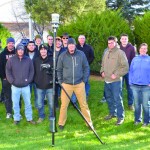
Surveying and Geomatics Engineering Technology By Adam Thayer One of the many things I enjoy about this program at Idaho State University (ISU) is the history and investigations involved with surveying, specifically boundary surveying. There is nothing quite like finding an original stone or visiting a monument that hasn’t been uncovered since it was originally […]
Shark Week at Pangaea
With Discovery Channel’s “Shark Week” taking a big bite (sorry couldn’t help it!) out of my 4th of July weekend, my thoughts naturally turned to unmanned systems. Well, actually, thoughts on how unmanned systems are being used to study sharks with an eye to protecting both them and humans. Let’s start with that last application, […]
Higher-ed Profile: Curtin University
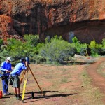
Department of Spatial Sciences By Bert Veenendaal, PhD The Department of Spatial Sciences at Curtin University is recognized throughout Australia for providing leading university-level teaching and research programs in surveying, GIS, remote sensing, mine and engineering surveying, and related areas. It consists of a motivated and enthusiastic team of internationally experienced educators and researchers who […]
Pokémon Go Leads the AR Revolution
Six months ago when I claimed that augmented reality was the future of GIS and geospatial services, it was met with a few sniggers. This week has seen the arrival of Pokémon Go, one of the most popular games to hit the mobile phone market, and yes, it is augmented reality and yes, it is […]


