June 2020 Archives
Scans, Soundings, Surve and Sailcargo: Building Ceiba with Surveying
Timeless maritime arts and craftwork mixed with modern technologies—including high-precision surveying—are helping reintroduce wind power to seaborne trade in Ceiba. It was a chance meeting that changed two lives. It may also change the way the world thinks about maritime shipping. It’s Ceiba! An accomplished sailor, Danielle Doggett loves tall ships—the large wind-powered sailing vessels […]
What is ETL…
and How Can it Turn You into a Geospatial Rock Star? Imagine a world where there was only one data type for 3D, 2D and point clouds. Wouldn’t it be bliss? I have to confess that about 30 percent of my time, when I work in GIS, is spent working between different data formats…a DWG […]
The Early Days of 3D Scanning
When I first came across Cyra Technologies Inc., a start-up that was developing 3D laser scanning, I was working at Trimble Navigation in Sunnyvale, California, in the heart of the San Francisco Bay area’s “Silicon Valley.” I consider myself lucky. I had the good fortune to be deeply involved in the very beginning of 3D […]
BIM It Up and Fly Them In, Mactan-Cebu Airport!
Designed using building information modeling, Mactan-Cebu International Airport is a tribute not only to technology but also team collaboration and creativity. Featured image: Photomontage (by Marcel Lam) shows the BIM model combined with an actual photo of the Mactan-Cebu International Airport’s roof. Everything about the design of the newly built Terminal 2 at the Mactan-Cebu […]
SLAM, Bam, Thank You Ma’am: Giving Preservation a Hand(held)
Handheld SLAM mapping technology helps preserve historical sites for future generations. Across the world, places of historical significance are regularly monitored to ensure they are cared for properly and preserved for future generations. This care and attention can help us learn more about our past and inform design and building projects of the future. When […]
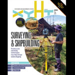
xyHt Magazine! Digital Edition for June 2020
xyHt is back in print! But if you don’t have a subscription, or if someone else in the office has snaffled your copy (or copies?) already, never fear—here’s the digital edition. Click here to view the June 2020 issue of xyHt magazine. Articles in the issue include (links will turn live throughout June, as they […]


