
EuroSDR is a not-for-profit organization linking national mapping and cadastral agencies with research institutes and universities in Europe for the purpose of applied research in spatial data provision, management and delivery. Over the last few years they have ran several projects, one of particular interest being in the use of BIM (building information modeling) and geo-data in practice.
In both the geo and BIM domains, it is widely acknowledged that the integration of geo-data and BIM-data is beneficial and a crucial step in facing the multi-disciplinary challenges of our built environment. The result of this integration – broadly termed as GeoBIM – has a range of potential uses. From the data perspective, this integration raises the question of how to integrate very detailed design and construction data from the BIM domain with contextual geospatial data.
The first phase of the project reviewed the current status of GeoBIM in participating countries and identified the need for specific detailed use cases to overcome both the lack of awareness and the lack of understanding of the potential of GeoBIM. The second phase was to look at how GeoBIM was used in practice, these were related as “GeoBIM” conferences and papers from 2018 onwards. Some of the papers are available here: https://search2.ucl.ac.uk/s/search.html?query=geobim&collection=ucl-discovery
This year, University College London (UCL), held the latest EuroSDR GeoBIM conference in September, called the BIM/GIS integration workshop, and I was lucky enough to attend.
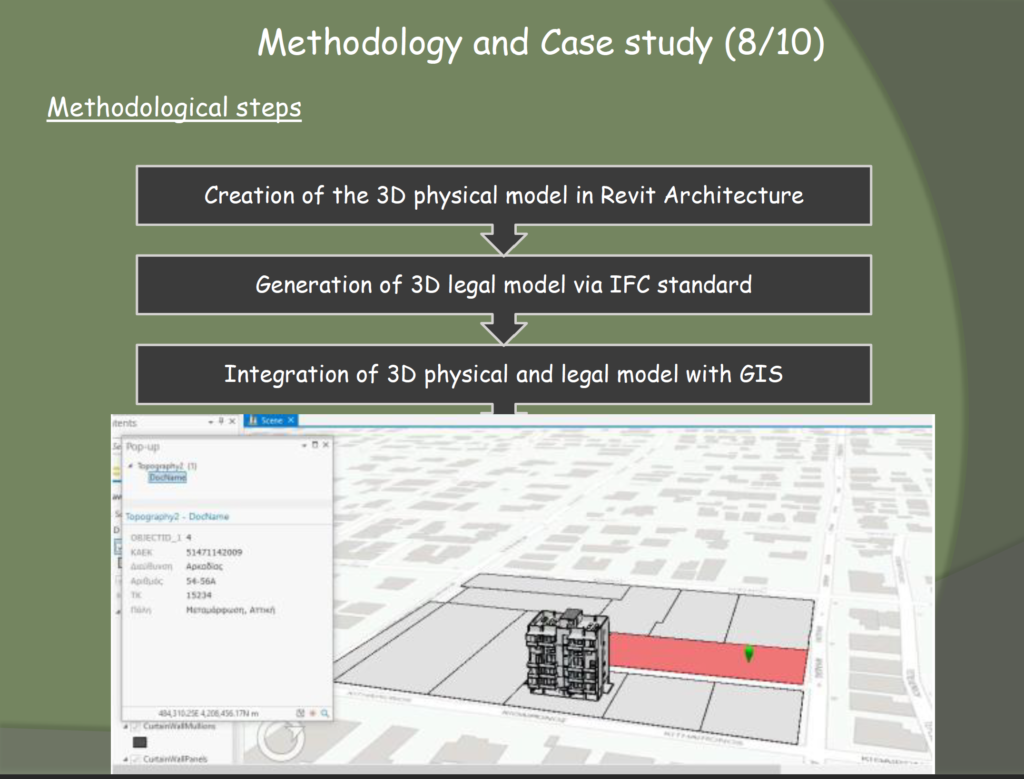
Slide from: Commission VI, WG VI/4,D.E. Andrianesiand E. Dimopoulou, School of Rural and Surveying Engineering, National Technical University of Athens
The first two days focused on BIM and GIS, tackling the challenge of working between the two systems, with lots of methods and discussion over ways of “simplifying” IFC (BIM) information parsed to geospatial data when to be viewed contextually in a GIS or viewer and also the reverse. As you can imagine from a conference held by a university, there was quite a lot of academic views, but to ground these there were several talks from industry experts and companies using these methods in practice which was extremely informative.
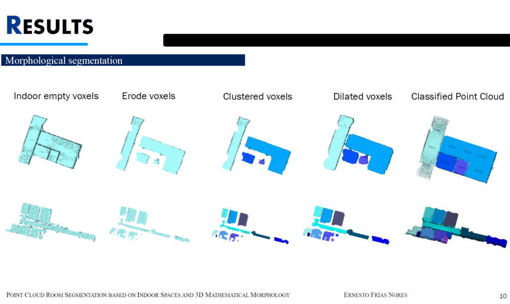
Slide from: Point Cloud Room Segmentation Based on Indoor Space and 3D Mathemtical Morphology. By Ernesto Frías, JesúsBalado, LucíaDíaz, Henrique Lorenzo
The next few days focused on 3D geographic information, and there were talks on many sectors and types of 3D geographic information, such as indoor mapping and improvement using machine learning, underground data definition, 3D versus holographic and interactive 3D information in virtual reality, to name but a few of the interesting talks.
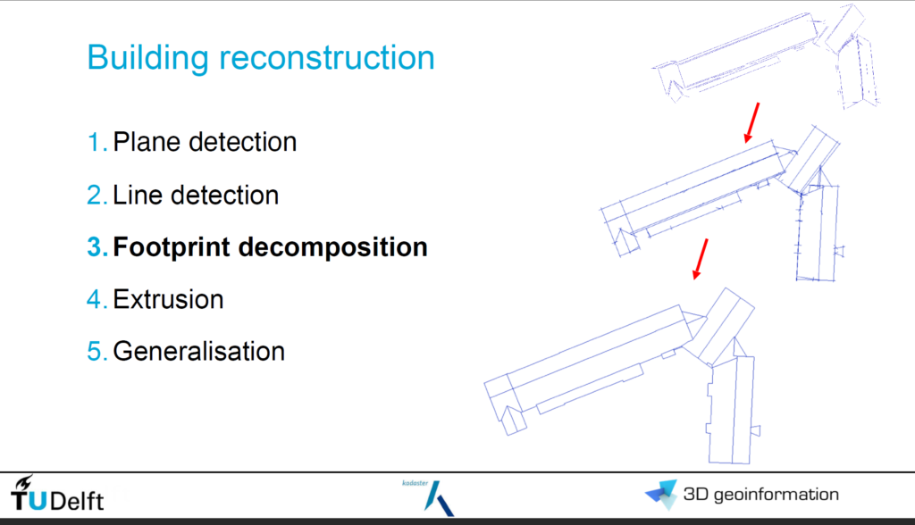
Slide from: Generating, storing, updating and disseminating a countrywide 3D model. By Balázs Dukai1, Ravi Peters, Teng Wu, Tom Commandeur1, Hugo Ledoux1, Tony Baving, Marc Post, Vincent van Altena, Willem van Hinsbergh2, Jantien Stote, 3D geoinformation group, Delft University of Technology
With the new UK National Underground Asset Register (NUAR) project currently underway thanks to the Geospatial Commission, it was great to hear a few talks on modeling, representing and integrating underground information. This was a project ordnance survey looked at undertaking for the UK around 15 years ago but dropped due to the complexities, inaccuracies and also the data caveats provided by the parties holding the data.
Although academic in part, seeing the companies putting this all into practice and the methods of employing GeoBIM real projects made this an invaluable conference which I would love to attend in person.