This past September, surveyors gathered to learn about and participate in the history of the Washington/Canadian border and the San Juan Islands.
 It was a fun and exciting time this year at the Surveyors’ Historical Society’s (SHS) annual rendezvous. Amidst the beautiful scenery of Washington State, surveyors from all around the country gathered for a remarkable weekend. Presentations—covering the lives of sailors, cartographers, and surveyors—brought attendees up to speed on the short yet bountiful history of the Washington/Canadian border and the San Juan Islands.
After learning about the area’s past through lectures, the SHS set off to experience it in person. Visiting both the San Juan Islands and Peace Arch brought guests the opportunity to explore and understand the amazing work done by surveyors of the past. By the end of the event, participants had not only learned about Washington’s history, but held a part in restoring it.
Brief History
In 1846 during an ongoing dispute between the United States and British North America, a treaty established the 49th parallel as the land border between the two countries. When the 49th parallel reached the Strait of Georgia, the border was to turn south and head through the middle of the Salish Sea.
 Unfortunately, as every surveyor knows, a boundary description consisting of “through the middle” and lacking more specific details quickly falls into dispute. People of both the U.S. and Britain resided on the debated islands, which eventually led to conflict. In 1859 an American settler discovered and shot a pig that was rummaging through his garden. This animal belonged to an employee of the Hudson Bay Company. Debate over jurisdiction began, eventually escalating to the infamous “Pig War.” Thankfully, the supposed war consisted only of military personnel being stationed on the islands with no battles taking place.
However, this event forced a resolution to be decided, and in 1872 an agreement made Haro Strait the final boundary. These historic conflicts were commemorated by national parks on the San Juan Islands and by the Peace Arch State Park on the boundary between the U.S. and Canada.
Events of the Week
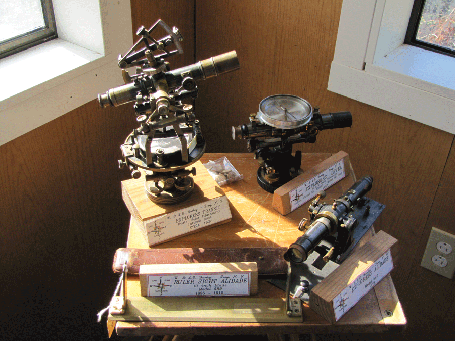
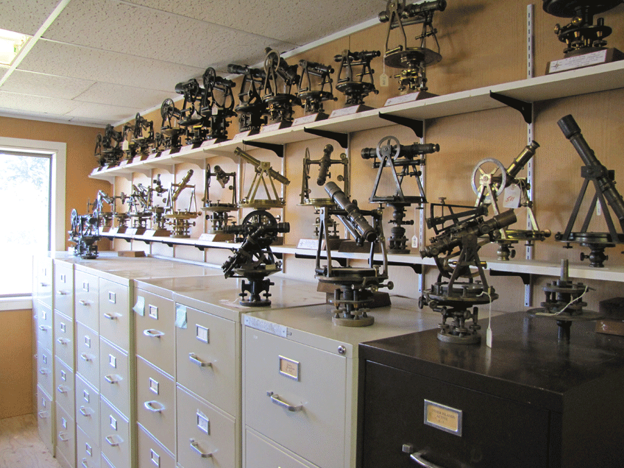
John Thalacker’s historical collection includes these Gurley instruments from the early 1900s.
After learning the history of these two areas, the rendezvous group set out to visit them. First on the list was San Juan Island itself. Leaving by ferry early Friday morning, all travelers were greeted by beautiful island vistas. The trip consisted of a tour of the American and British military camps and a visit to the home of John Thalacker to see his astounding collection of classic surveying instruments.
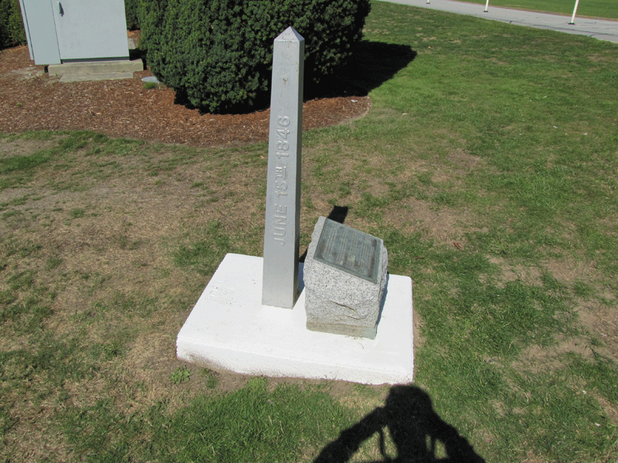
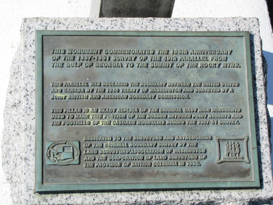
Next was a Saturday afternoon trip to the Peace Arch. One item of particular interest is an exact replica of a cast iron monument that had been destroyed in 1986. This monument was one of the original markers of the 49th parallel and is a remarkable piece of history that was replaced due to the efforts of Denny DeMeyer, SHS member and organizer of this year’s event, and the Land Surveyors’ Association of Washington (LSAW). The trip to the Peace Arch helped substantiate the magnitude of work surveyors had in establishing the country.
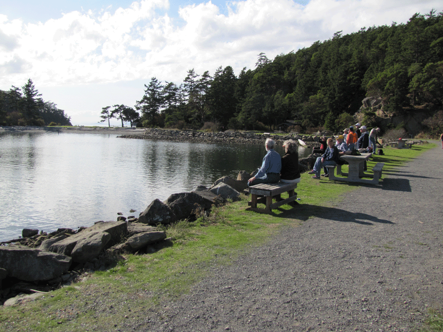
Sunday’s activity, the most exciting trip of the event, was a visit to Sucia Island. While the beautiful scenery on the way to the island was breathtaking, the highlights of the day were the activities planned for the afternoon. Upon arrival, Denny DeMeyer began installation of a new information kiosk display outlining the locations of survey monuments on the island. Accompanying the map of monuments was a brief history of the timeline when surveyors would have been on the island and their significances. After a quick dedication, the exhibit was mounted to its permanent location.
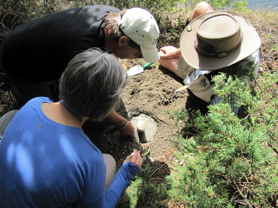
 The rest of the day was devoted to monument hunting and restoration. Attendees were welcomed to either wander the island in search of monuments or take part in restoring three worn monuments on the southern side of the island. DeMeyer led the charge for the monument restoration. Issuing cement, mixing buckets, and clear instructions, he directed three teams to reestablish these important pieces of history.
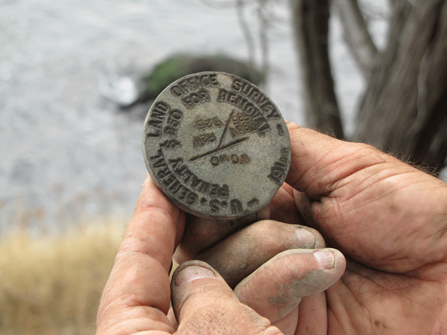
The monuments being repaired were three brass caps, two of which were the originals still intact just needing to be reset, and the third needing to be replaced entirely. Repair and installation of the markers was fairly simple as the original pipes fastening the brass caps into the ground were still in place. After confirming their location, the brass caps simply had to be cemented in.
While monument renovation was taking place on the southern part of the island, “treasure hunts” for monuments began on the northern side. Given a map with little more than the general locations of monuments, groups of excited surveyors raced out to see as many of these amazing points as possible.
 Among these seasoned explorers were two particularly ambitious adventurers; their target was a brass cap yet to be rediscovered. This brass cap was originally a part of the same survey as the set being mended on the opposite end of the island and was known to exist from documentation. After finding themselves in the general area believed to hold the historic item and with no way to accurately narrow the location, surveyor’s intuition came into play at its finest. Making use of years of experience, the two scoured the landscape, managing to find the previously elusive marker.
Feeling accomplished, the group returned on a charted ship to the mainland. While aboard, a meal was served as passengers relaxed and shared stories about the history and their triumphant excursions on Sucia Island. As surveyors arrived at the hotel, anticipation for next year’s event had already begun.
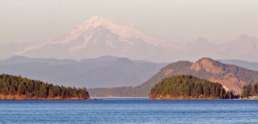
Society members were treated to a view of Mt. Baker while ferrying to events on nearby islands.