
Sponsored by NCEES
Get your end-of-year credits. Click here to learn more.
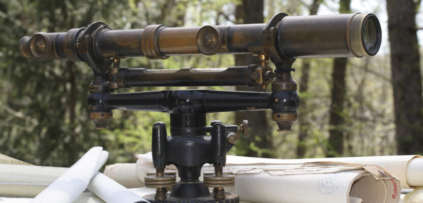
Surveying is a fascinating and wonderful profession–just think about the great things that we have the opportunity to accomplish from day-to-day. We may create a new tract of land through subdivision which allows a young person to have a new home on their own piece of property, or we may settle a property dispute between two parties that will allow for peaceful existence into the future. Not only those types of cadastral surveys, but what about the large aerial mapping projects that require ground control? Those projects often lead to the design of major land improvements, including highways, buildings, parks, etc. The list goes on and on.I think it’s always good to remember the wonder and awe that we all had when we first realized how awesome the profession of surveying is. Do you remember your first introduction to the science and math of surveying? I remember the first time I was shown how to read a Vernier on a transit. Yes, of course, I’m aging myself now, but that was the main type of instrument being used for turning angles on basic surveys in the late 1970s. We also used scale-reading theodolites at the firm where I worked, but I wasn’t allowed to touch them until later.
My father had been a machinist, and he taught me how to read a micrometer, which used a similar type of scale to measure the thickness of machine steel. So when I first saw a Vernier, I wasn’t completely confused on the method of finding the etched lines which coincided to read a value on a scale. I was amazed that there was a method to measure angles to a finer gradation than the nearest half-degree, like we did with a protractor in high school geometry.Perhaps in your career, you remember the first time you saw a total station and data collector being used to collect data; literally at the speed of light. Can you remember the amazement and wonder you had when you realized how this system worked and what it meant to have that data translated into coordinates? Or, maybe your first introduction to surveying was with GPS, before everyone had one in their car or hand-held device. I think that was the most mind-boggling thing for all of us to experience and imagine what had to go into the inception and development of such technology. Of course, now with network GPS, we can push a few buttons and (theoretically) obtain centimeter-level coordinates in a matter of minutes.I think it behooves us to remember the fascination and wonder that got us hooked on the profession of surveying in the beginning of our careers. Sometimes we may just take a lot of these things for granted and allow ourselves to become disenchanted and maybe even disgruntled with the hum-drum routine of our work.
Some years ago, the firm where I work was asked to do a subdivision to create some residential building lots on a farm. This farm property had frontage on two roads. It was a long and narrow piece of property with the old farm house and outbuildings in the middle, near a creek that traversed the land.When I met with the young couple who had just bought the property, I learned that they moved into the old farmhouse because the wife had fallen in love with the setting and they had moved into the local, rural area from a more urban setting. They were raising a young daughter and they wanted to raise her in an idyllic setting of a farm.When they had their discussion over the cost of the land, the wife had suggested that they could sell some lots along the road frontage and still have their piece of paradise in the middle of the farm, where the house and barn were located. The husband told her that he had been involved in land development before and didn’t want any part of it, but invited her to manage the project and get the lots created.I was the project manager and surveyor for the subdivision and it was a difficult one, with various permits needed and several hurdles to clear in order to get the final approvals for the lots. In the end, everything worked out and they made their dreams come true.The main reason for telling that story is not to brag about my accomplishments; any surveyor could have completed the process. It’s only to point out that what we do is extremely important and can make a world of difference for the clients that we serve. Not only should we be reminded of how great the technology is, but how about what our work provides for others? As stated in the opening paragraph, the work we do makes a major impact in people’s lives and the world in which we live.