Tag Archives: ArcGIS
Calculating Geometry outside ArcGIS Pro
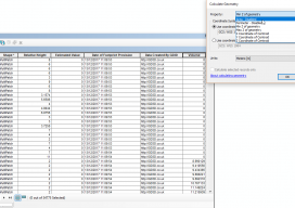
Let’s be clear: this isn’t a stab at the all-new, singing and dancing Esri software. This post is meant to help those who are using the software on a regular basis but finding issues with using the fields with multipatch data. Recently I’ve been working with calculating volumes of buildings that are multipatch data. For...

xyHt News Links: 2/24/17
EngineerSupply Expands With GeoMax Surveying Equipment Company EdgeData & Harris Corp Will Collaborate on Electric Utility Mgmt. Solutions Pokémon Go the Geospatial Gamechanger: Six Months Out ArcGIS Solution Provider and Esri Business Partner, GEO Jobe, Launches GIS Knowledge Base
xyHt News Links: 1/13/17
How much does ArcGIS Online REALLY Cost? Geospatial Professionals Receive 2016 MAPPS President’s Awards for Service Vanilla Aircraft claims record with 56-hour unmanned flight Textron Systems Begins On-Water Testing for Common Unmanned Surface Vehicle (CUSV™) Sanborn Launches Mezurit.com for Subscription-Based Oblique Imagery Viewing and Analytics
xyHt News Links: 12/30/16
Latest Release of TerraGo Edge and TerraGo Magic Provides Seamless Integration with Esri ArcGIS Esri Unveils CityEngine Mobile Virtual Reality Solution Laser Scanner in a Backpack
Vertical Transformations and GIS
You know those moments where you are sitting in a pub, the office, or at a friend’s house and you say something, then suddenly wonder why you haven’t thought of it before? I had that very issue in the Brew Dog pub near Spitalfields in London, UK a couple of weeks ago. You see, I...

QGIS 2.14 vs ArcGIS Pro 10.4
This post almost didn’t happen. For over seven years I’ve been comparing GIS software in the hope that someone would be reading and take it upon themselves to fix a few of the issues that we all run into on a daily basis. With the new releases someone told me something, and it almost stopped...