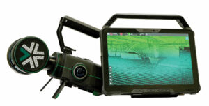
A modular mapping and surveying ecosystem that allows users to quickly capture highly accurate, colorized, real-time 3D point clouds in complex, dangerous, or inhospitable environments like those in the mining, AEC, and geospatial industries.
Autonomous LiDAR Mapping and Navigation – Here When You Need It
Our proprietary autonomy algorithms, coupled with our SLAM-based LiDAR scanning technology deliver survey-grade results without a pilot. The operator simply sets the area to scan and the system determines its own route. Start with mapping only, then upgrade to full autonomy when you need it.
 Capture Survey Grade Data – Fast
With fast on premise processing, get real-time visualization of your captured data with full detail and colorization in the field to ensure the scan area is correct and complete before you leave the site. Adaptable to changing environments, Nexys’ SLAM-based spatial mapping is capable of capturing up to 1.9 million scan points per second at up to 5mm @ 1 sigma, while continuously updating the map as new data is received.
Versatile Deployment
Designed to be highly versatile and ruggedly ergonomic, the Nexys can be quickly and easily switched between a variety of configurations, giving users the flexibility and cost efficiency to use one device in any mapping environment – inside, outside, below ground, short or long distance, autonomous or piloted, connected or not connected to communications networks.
 Deployment Options for Every Use Case
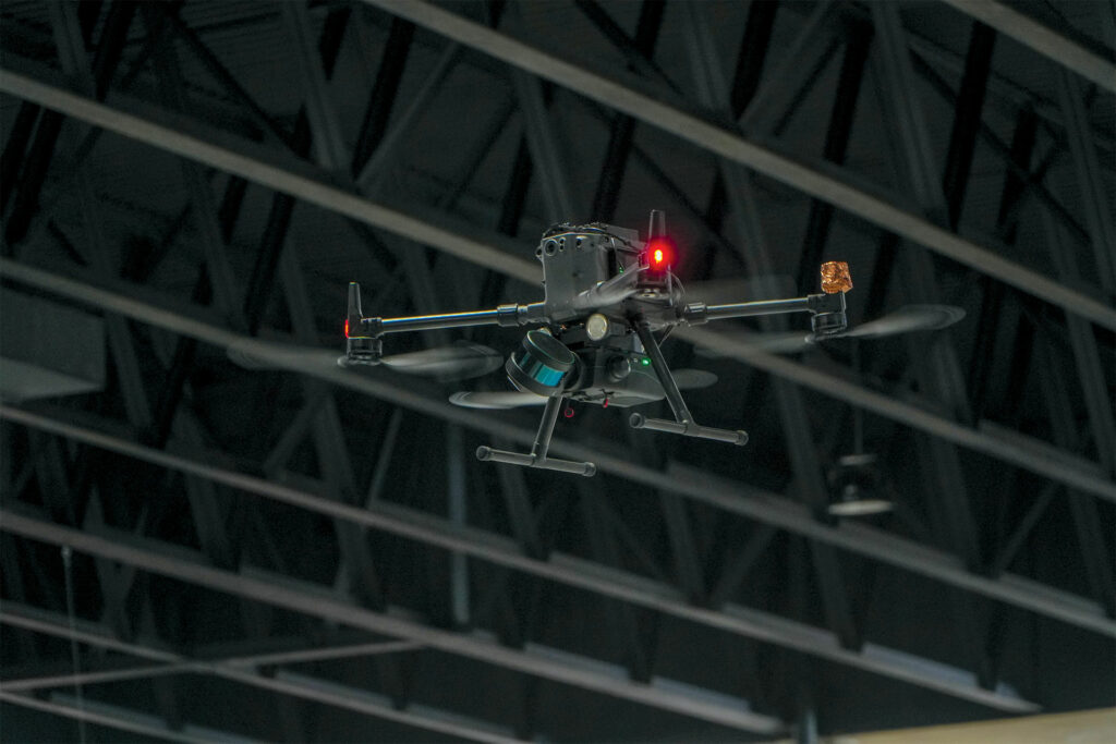
Aerial Robots
Use our autonomous mapping with a growing number of drone models, or you can choose mapping-only on a compatible drone that you pilot yourself.
Terrestrial Robots
Choose to use our autonomous mapping with a growing number of ground robots, map the route yourself with a compatible self-piloted robot, or use the robot’s integrated semi-autonomous mode.
Handheld
Nexys’ lightweight, ruggedly ergonomic design makes it easy to carry for handheld scanning operations.
Backpack Mount
Our ruggedized, water resistant backpack holds and powers Nexys while scanning, and also serves as a storage and travel case.
 Vehicle Mount
Nexys can be easily and securely mounted to almost any vehicle or surface, allowing you to capture a complete map in rugged environments.
Custom Interface
The Nexys mounting interface ships with all units and may be used to securely mount Nexys in a variety of mounting configurations.
Visit: www.exyn.com/products/exyn-nexys