Tag Archives: CAD

What AI Can Do for GIS
Part 2 By Juan B. Plaza and Giulio Maffini Before we can even attempt to describe what AI can do for GIS, we need to understand what a GIS is and how it is used. What do these three letters mean? A pretty good definition is: A geographic information system consists of integrated computer hardware...

BIM: Into the Future
Looking Forward The concept of building information modeling has existed since the 1970s, although we certainly didn’t recognize it then. That’s when the first software tools developed for modeling buildings started to emerge. Those early applications and the computers needed to run them were expensive, so adoption wasn’t widespread. BIM gradually evolved, though still far...

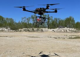
Tackling the Aerial-to-CAD Bottleneck
Aerial capture is getting easier and faster, but the subsequent step of CAD linework generation is a bottleneck—especially given the present shortage of qualified drafters. AI is stepping in to help. In 2017, the co-founders of what would become AirWorks Solutions Inc. first met and began discussing ideas for a new geospatial venture. Both had...

xyHt Magazine Heights 2023
Click on the cover to view the Heights 2023 supplement to xyHt magazine. Articles in the issue include: From Nadir to Oblique: From traditional airplanes to new-fangled gyroplanes, we take a look at several aspects of the aerial geospatial technologies that just keep getting better. The Future of Photogrammetry: While UAVs continue to emerge as aerial mapping vehicles, there...
Fusing Aerial and Mobile Lidar Data
Creating accurate as-builts of a complex facilities is no longer a long-term project. When the Caltech Group was founded by two men in Calgary, Alberta, in 1990, they set out with the goal of becoming Western Canada’s go-to company for geomatics services with an eye on specializing in the oil, gas, and utility areas—those companies...

Sponsored: Making Sustainable Growth – Attainable
Land Surveyors have always been at the forefront of technology, beginning with the first electronic distance meter, the HP 3800 in 1975, to today’s robotic stations. In the field, Land Surveying has enjoyed more technical progress than many other non-medical fields. Yet, in the office, survey plans and subdivision plans appear the same as if...