Tag Archives: carlson
True 3D Design
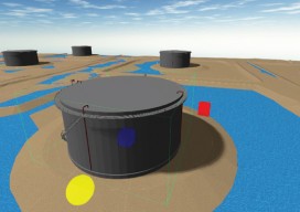
New geospatial software combines the appeal of games with the rigor of applications. It’s never been done before: applying the rigor and disciplines of civil engineering, mining engineering, hydrology, and even classic survey field-to-finish to game-like 3D design. Sure, CAD operators have had 3D viewing for years, which they use to review the results of...
Feature: Survey <---> GIS
Finally you can work with survey data in a GIS environment and preserve its integrity and precision; check out the Carlson SurvPC Esri OEM. By Bruce Carlson and Gavin Schrock, PLS With apologies to Kipling: “GIS is GIS and surveying is surveying, and never the twain shall meet.” This is not really true … The...