Tag Archives: lidar
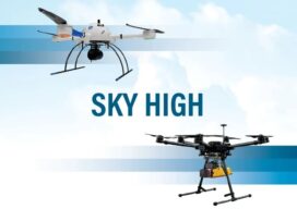
Sky High
UAVs deliver practical and highly technical mobile mapping Collecting imagery with uncrewed aerial vehicles (UAVs) is ideal for a variety of applications including topographic mapping, forestry ground and canopy measurements, powerline corridor mapping, Digital Terrain Model (DTM) generation, high-resolution digital imagery, and orthophoto production, along with support for a variety of other mapping needs. Historically,...

xyHt Weekly News Recap: 11/04/22
RIEGL announces NEW VZ-600i Hexagon to Update Aerial Data of Eight U.S. States at Six-Inch Resolution in 2023 Bracell Wins EU Esri 2022 Award with Geoprocessing Project SuperMap Showcased GIS Technologies and Solutions at INTERGEO 2022 Topcon Invests in the Future of Construction with Donation to TU Dublin VOTIX Software Allows AviSight to Achieve BVLOS...
xyHt Weekly News Recap: 10/28/22
INTERGEO Celebrates a Successful Comeback Fathom launches new Global Flood Map Innoviz and Kudan Team Up for Lidar-Based Geospatial Mapping Solution Across Industries Cartegraph and Center for Digital Government Share Results of Infrastructure Funding and Technology Survey Leica AP20 AutoPole wins Wichmann Innovations Award at INTERGEO 2022 New Lidar Solution Delivers Survey-Grade Data from UAV...
xyHt Weekly News Recap: 10/21/2022
Teledyne Announces Ladybug6 Cameras for High Accuracy 360-Degree Spherical Image Capture Hexagon and LocLab Work to Accelerate Adoption of Smart Digital Realities Vexcel Imaging Introduces UltraCam Eagle 4.1 Photogrammetric Aerial Camera System Phase One to Launch New Calibration Center at Denver Headquarters Soaring Eagle Technologies Receives Long Distance FAA Waiver for UAS Inspections Common Ground Alliance...

UAS and ALTA Surveys – Part One
Recognizing that with the right equipment and practices, specifications for ALTA surveys can easily be met, surveyors have rapidly adopted UAS for these and many other types of surveys. The adoption of UAS in the surveying profession has been more rapid than some past tech. It was only 2016 when the FAA Part 107...
xyHt Weekly News Recap: 08/19/2022
Lidar Technology Confirms Existence of Lost Amazon City Trimble Introduces RTX Integrity for Positioning Data Accuracy Duke Robotics Introduces Revolutionary Drone Technology Sanborn Invests to Support Customer Demand Esri Book Reflects on COVID-19 Lessons and How GIS Technology Helped USGIF Announces 2022 Scholarship Award Winners CONEXPO-CON/AGG & IFPE Announce Inaugural Next Level Awards Program Phase One...