Tag Archives: lidar

xyHt Weekly News Recap: 06/17/2022
IMAGINiT Develops Additional Time-Saving Utilities for Autodesk Revit Surveying Shallow Water from Space Trimble Introduces OEM GNSS Receiver Module for Industrial Autonomy Applications Geo Connect Asia 2022 Hosts Close to 2,000 Professionals from 36 Countries Drone Nerds Introduces Advanced Mapping and Surveying Solution, the ViDoc RTK Rover Expedition to Deepest Point on Earth Will Collect...
xyHt Weekly News Recap: 06/10/2022
IMAGINiT Develops Additional Time-Saving Utilities for Autodesk Revit Surveying Shallow Water from Space Trimble Introduces OEM GNSS Receiver Module for Industrial Autonomy Applications Geo Connect Asia 2022 Hosts Close to 2,000 Professionals from 36 Countries Drone Nerds Introduces Advanced Mapping and Surveying Solution, the ViDoc RTK Rover Expedition to Deepest Point on Earth Will Collect...
xyHt Weekly News Recap: 05/27/2022
New Energy Performance Data in XMAP Helps Tackle Climate Change Trimble Introduces High-Accuracy OEM GNSS Receiver Module Atmos Integrates Topcon Hardware to Create All-in-One Surveying Solution Fugro’s Lidar Geo-Data Supports OPW’s Irish Coastal Resilience Strategies Censys Technologies and American Aviation Regulator Complete BVLOS Emergency Response Project Applications Invited for URISA’s Vanguard Cabinet (URISA) Australian Company...
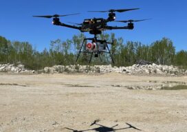
Fusing Aerial and Mobile Lidar Data
Creating accurate as-builts of a complex facilities is no longer a long-term project. When the Caltech Group was founded by two men in Calgary, Alberta, in 1990, they set out with the goal of becoming Western Canada’s go-to company for geomatics services with an eye on specializing in the oil, gas, and utility areas—those companies...

Geospatial Services for Transportation & Utilities
GPI Geospatial, Inc. has been a premier provider of geospatial solutions for over 48 years. Our mission is to map the foundation for infrastructure, transportation, and land improvements that enhance the connectivity between people and communities. It’s our vision to be the most trusted provider of precision mapping, imagery, LiDAR, and surveying services within the...
xyHt Weekly News Recap: 05/06/2022
NSPS to Host Virtual Town Hall on Davis Bacon Act Regulations LiDAR for Drone 2022 Conference Set for June 13-14 in France World’s First Expandable Wing UAS Launches at AUVSI XPONENTIAL Army Corps of Engineers Picks Aero-Graphics for Geospatial Mapping and Surveying High precision mapping and automated workflows IDS GeoRadar launches cloud-based AI solution AiMaps...