Tag Archives: mapping

xyHt Weekly News Recap: 05/06/2022
NSPS to Host Virtual Town Hall on Davis Bacon Act Regulations LiDAR for Drone 2022 Conference Set for June 13-14 in France World’s First Expandable Wing UAS Launches at AUVSI XPONENTIAL Army Corps of Engineers Picks Aero-Graphics for Geospatial Mapping and Surveying High precision mapping and automated workflows IDS GeoRadar launches cloud-based AI solution AiMaps...
Providing Comprehensive Geospatial Solutions
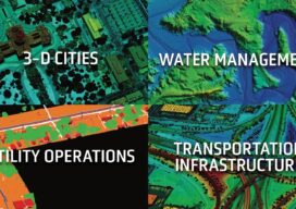
Sanborn is a full-service geospatial company that has been in continuous operation since 1866. Today, Sanborn is an innovator in the modern geospatial industry, delivering state-of-the-art mapping, visualization, and 3D solutions for customers worldwide. Sanborn offers comprehensive geographic information solutions to city, county, regional, state, and federal government agencies, private companies, and international clients. Our...
xyHt Digital Magazine: May 2022
Like a good surveyor, xyHt’s May issue covers a lot of ground, bringing you stories about UAV/UAS, Lidar, Aerial Imagery and Mapping. As always, if you don’t have a subscription to our print edition, or if someone else in the office has snaffled your copy, don’t fret, here is the digital edition. Click here or on...
xyHt Weekly News Recap: 04/22/2022
Biden Administration Plays Up Billions for Rural Infrastructure AGI Welcomes Business Development Specialist Angela Arriaga Trimble and Infotech Expand Collaboration to Improve Inspection Efficiencies for Infrastructure CHC Navigation Introduces Airborne Lidar Series Drone Nerds Displays Emerging Drone Technology Solutions at AUVSI XPONENTIAL NSPS Cosigns USGS Streamgages Letter PAR Government and BlackSky Deliver Near Real-Time Imagery Russia is...

Blowing in a New Direction
A new market is emerging for aerial mappers as investment in renewable energy grows Public and private utilities are focused on diversifying their energy portfolios after years of research and testing have improved the efficiency and reliability of alternative power generation methods. Support for the development of clean-energy options has never been stronger, creating an...

When a Drone Just Can’t Do It
There is a growing ebb in the tide of UAS adoption for aerial surveying, mapping, and remote sensing—finding the right balance between manned and unmanned aerial operations Unmanned aircraft systems (UAS), remotely piloted aircraft systems (RPAS), or just plain old “drones”—call them whatever you wish—have had a tremendous impact on geospatial industries. A decade ago,...