Tag Archives: mapping

The Future of Aerial Photogrammetry
Rapid advances in technology are changing the way we map from the air, but the 100-year-old technology of mapping by crewed airplanes will continue to fly into the future For thousands of years cartographers made maps using tools that mostly measured angles and distances, allowing for positioning of fixed objects over unknown topography. The earliest...
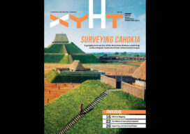
xyHt Digital Magazine: April 2023
xyHt’s April issue focuses on surveying, including modern technologies being used in a massive geophysical survey and historic equipment that got the profession to where it is today. As always, if you don’t have a subscription to our print edition, or if someone else in the office has snaffled your copy, don’t fret, here is the...
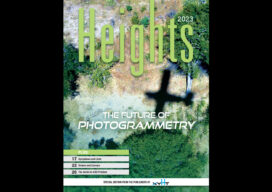
xyHt Magazine Heights 2023
Click on the cover to view the Heights 2023 supplement to xyHt magazine. Articles in the issue include: From Nadir to Oblique: From traditional airplanes to new-fangled gyroplanes, we take a look at several aspects of the aerial geospatial technologies that just keep getting better. The Future of Photogrammetry: While UAVs continue to emerge as aerial mapping vehicles, there...

xyHt Weekly News Recap: 03/31/2023
The First 30cm High-Definition Global Imagery Basemap Woolpert Opens Paris Office, Expands Support for European Customers CNH Industrial to Acquire Hemisphere GNSS Automation Asset Inspection Company Thread Expands into Canada Esri Book Demonstrates How to Create Map Apps with User Experience in Mind The Integration of BIM Data and City Models Using Geo-BIM VOTIX and Iris Automation...
xyHt Weekly News Recap: 03/24/2023
The American-Made CAP50 Drone Takes Flight Geo Connect Asia 2023 Draws Strong International Attendance Progress on Second-Gen Galileo Capabilities Graphisoft’s Archicad Collaborate Makes BIM Technology More Accessible This 89-year-old has Attended CONEXPO-CON/AGG for Six Decades Bluesky Partners with SkyFi to Widen Global Access to Aerial Imagery Airbus Signs Agreement with TerraNIS to Export Farmstar in...
xyHt Weekly News Recap: 03/17/2023
Mach9 Launches New Geospatial Production Software for Global Infrastructure National Geodetic Survey to Present NGS DAY at FIG Working Week Become an Exhibitor and Sponsor at FIG Working Week 2023 Surveyors Exempt for New Universal License Recognition Law in Virginia Topcon Further Expands MC-X Platform for Compact Equipment Advisory Board Announced for Commercial UAV Expo...