Tag Archives: #photogrammetry

BIM, a Basilica, and a Balloon
An award-winning digital twin project is interesting on many levels, and not just because it features one of the world’s most famous landmarks. Shown above: The AI-driven camera-based solution Italferr developed to capture the upper dome and galleries. Source: Italferr Davide Porzio, CDE manager, BIM coordinator, Italferr S.P.A. speaks enthusiastically about building a digital twin...

xyHt Weekly News Recap: 09/29/2023
Trimble and Kyivstar Partner to Provide GNSS Correction Services for Applications in Ukraine Virtual Surveyor Unveils Photogrammetry App in Major New Release of Smart Drone Survey Software Emlid Releases Reach RS3 GNSS Receiver with Tilt Compensation Esri and NSPS Present Surveyor’s and GIS Webinar Series Thailand to Launch THEOS-2 into Space on October 7th! A...
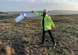
A Decade of Uncrewed Photogrammetry
Some might have had a peek at photogrammetry drones before 2013, but for me 2023 marks a decade since I first laid eyes on an uncrewed aircraft that “claimed” to do what I had been doing for years in bigger, more stable airplanes in the joyful company of pilots, copilots, camera operators, and navigators. In...
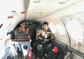
The Future of Aerial Photogrammetry
Rapid advances in technology are changing the way we map from the air, but the 100-year-old technology of mapping by crewed airplanes will continue to fly into the future For thousands of years cartographers made maps using tools that mostly measured angles and distances, allowing for positioning of fixed objects over unknown topography. The earliest...
UAS and ALTA Surveys
Part 3 Precision, accuracy, and completeness are the end goals of UAS post processing, but how you get there to meet ALTA standards requires extra care. In Parts One and Two of this article in the September and October 2022 issues of xyHt we looked at the time/cost/precision proposition of using UAS for elements of...
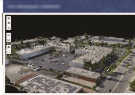
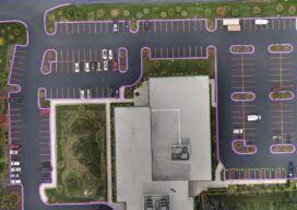
An Integrated Photogrammetry Solution
Carlson Software has innovated for the land development industry with software and hardware solutions built to work for the clients who depend on them every day. As a one-source solution, we provide CAD design software, field data collection, and laser measurement products for the surveying, civil engineering, GIS, and construction industries. Our flagship CAD program,...