Tag Archives: remote sensing

xyHt Magazine Digital Edition: September 2021
xyHt's September issue includes features on UAVs, deep learning, oceanography and adventure.
Remote Sensing – It’s About the Safety
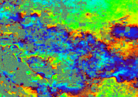
If you follow trends in industry that serve our profession, it is impossible to not see articles and advertisements about the use of remote sensing technology. Unmanned Aerial Systems (UAS/drones) tend to be the leaders of the pack for many reasons. However, there are several others, from stationary and mobile terrestrial lidar scanners and cameras,...
From Down Under to the Skies Over North America
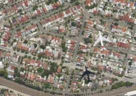
As aerial firms evolve and expand to provide imaging as a service (IaaS), the next step is 3D data services. A prominent Australian aerial services company, with success in the 3D data market, is eyeing an expansion into North America. Aerometrex Pty Ltd.—not affiliated with Aero-Metrics or Aerometrics—is a prominent aerial imaging, remote sensing, 3D...
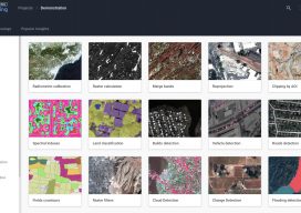
New EOS Platform Lets You Run Image Processing Tasks Online
Sponsored Content by EOS Data Analytics Most of your image analysis tasks that required ENVI or Erdas Imagine software are now available online thanks to EOS Platform. This new game-changing cloud service launched by EOS Data Analytics provides GIS professionals with a one-stop solution for search, analysis, storing, and visualization of large amounts of...

40 Under 40, 2017: Danielle Smilovsky
REMOTE SENSING SCIENTIST AND GIS ANALYST AT AMEC FOSTER WHEELER ARIZONA, USA WITH A BS IN ECOSYSTEM SUSTAINABILITY AND AN MS IN GEOGRAPHIC INFORMATION SYSTEMS, Danielle Smilovsky uses GIS and remote-sensing applications to study and analyze ground deformation around the world. She specializes in performing geotechnical land subsidence investigations using InSAR, SAR, lidar, and water...
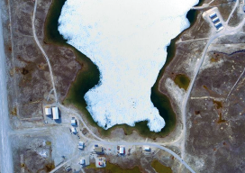
We Can Do This
“It was not a matter of ‘if’ we could do this project,” said Brian Mayfield, Atlantic’s president and chief operating officer. “It was a matter of how. Then there was the question of ‘Exactly how remote is Nunavut?’ What are the conditions, and what resources would be available?” The proposed project site, in an uninhabited...