“It was not a matter of ‘if’ we could do this project,” said Brian Mayfield, Atlantic’s president and chief operating officer. “It was a matter of how. Then there was the question of ‘Exactly how remote is Nunavut?’ What are the conditions, and what resources would be available?”
The proposed project site, in an uninhabited area of the Bathurst Inlet region of Canada’s most remote territory, was an exercise in terms of limited and non-existent project logistics. “We felt when we could demonstrate that we could pull this off, then we would have no problem competing in any market,” said Mayfield.
Atlantic has been in the business of remote sensing, surveying, and geospatial consultation since 2005, performing mapping projects for utilities, transportation, government entities, environmental agencies, and engineering design firms. The Nunavut project required expertise from every member of their team of surveyors, photogrammetrists, GIS experts, and remote sensing specialists, and it earned Atlantic the 2013 MAPPS Award for Excellence in the airborne and satellite acquisition category.
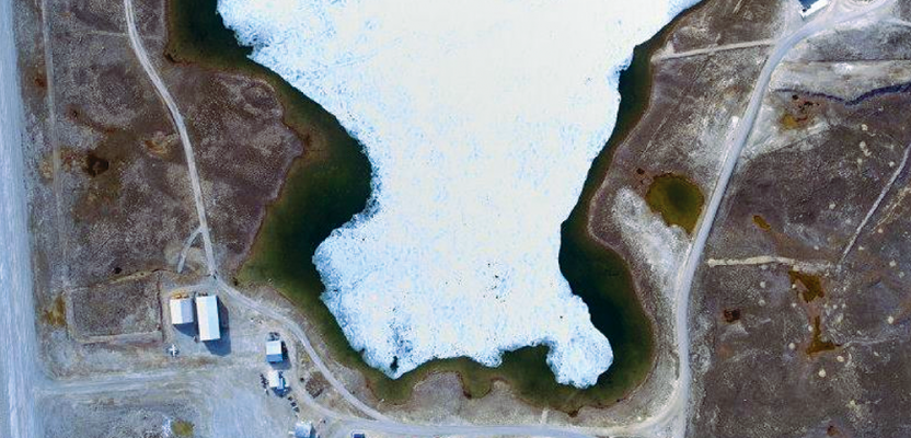
To support the environmental review of proposed development in this austere location, large-scale 3D elevation models and imagery were required. Included in the mapping contract was an 85km-long and 1.5km-wide corridor of interest, extending from Bathurst Inlet (where port development has been proposed) to a proposed mining region, plus a 25km-long mine access road and selected areas of the proposed mining region.
The nearest airfield (suited for project operations) at Cambridge Bay lies more than 300km northeast of the site—quite a remote site in its own right. Fuel for Atlantic’s Piper Navajo Chieftain 310-A, plus all other supplies—food, spare parts, and surveying gear—were delivered by barge. The two-person crew of the aircraft made as many as four round-trip flights over the project site per day. The Arctic summer provides near round-the-clock sunlight, but weather conditions can otherwise be challenging; fuel-use margins had to be carefully calculated.
Project logistics was not the only major challenge; project control certainly was another. The ability to set project control, establish GNSS base stations, or even tap GNSS Continuously Operating Reference Stations (CORS) is a granted for most terrestrial and aerial mapping jobs in populated areas of the globe. Though the client for this project had arranged for some control to be established in the proposed mining area, these were purely local references. While most aerial projects can benefit from multiple GNSS base stations with relatively short baseline lengths (10km – 30km) for differential or kinematic solutions, the only practical location for a base was at the Cambridge Bay airfield. For the GNSS component of the integrated inertial/GNSS processing of flight data, precise point positioning (PPP) was the only logical choice (see the “Why PPP?” sidebar). Atlantic performed tests in advance to make sure they could meet the client’s requirements for vertical accuracy for the lidar data: RMSEz 18.5cm.
In tests of PPP and inertial (IMU) processing, Atlantic found that there were sometimes biases in the solution between days and even flights in the same day. They employed what they call a PPP-derived “virtual base” to compare and calibrate between flights. In this case the term “”virtual base” should not be confused with RTK Network “virtual base” (e.g. VRS et al.). This far north there was no network of CORS involved; instead the flight would capture, in the lidar data set, the location of the one physical GNSS base set up by Atlantic at Cambridge Bay. This was done at the beginning and end of each flight, plus they captured locations of the local control marks at the remote site to act as virtual bases, with both lidar and camera.
Robert Yao-Kumah, senior geospatial scientist with Atlantic, explained, “We could see the definition of the [GNSS] antenna quite clearly in the lidar, and we could then compute the location of the [antenna reference point] very precisely.” With long observation times, PPP would establish a precise geodetic location for the Cambridge Bay antenna, and provided that the GNSS in the aircraft were to converge in PPP and run for a minimum of 4.5 hours (guidelines their own tests would establish), the integrated GNSS and IMU processing could meet the specifications.
For the flights, Atlantic installed on the aircraft their Leica ALS70-HP lidar sensor and a Leica RCD105 RGB medium-format camera system. These sensors are capable of meeting and exceeding the relative accuracies required by the client, enabling deliverables of 20cm color orthophotos, classified and calibrated lidar point clouds, 0.5m contours, hydro-conditioned digital elevation models (DEM), and lidar intensity orthophotos. The positioning data was processed in NovAtel’s Inertial Explorer 850 (IE850), which takes data from the NovAtel SPAN IMU, the GNSS receiver, and other sensors such as strap-down accelerometers.
(Integrated positioning solution hardware and software systems like those developed by NovAtel and other manufacturers have been standard for most recent aerial mapping projects. Variations on solutions are also commonplace for marine and maritime mapping and remote sensing and for the booming field of terrestrial mobile mapping where additional sensors like DMIs [a type of precise odometer] are often added. For high-altitude and long-distance data sets, factors like tropospheric conditions [that are typically mitigated for in differential methods like RTK or dense networks of bases] are much more difficult to deal with. IE850 uses GrafNav’s PPP processor to compute the tropospheric bias trajectory for base stations. Within the SPAN system, the IMU is synchronized directly to the GNSS receiver, and the GNSS decoder extracts the respective IMU data automatically.)
As it was only practical to establish the single base station at the airfield far from the site, Atlantic’s solution was to use the closing observation of the base antenna to determine such biases and apply this to the processing. Clock and orbit data products for PPP processing—available from the International GNSS Service (IGS), an international science cooperative that includes entities like NASA/JPL—were applied to post-processing in IE850. With data products for PPP processing readily available from many sources, such methods can be applied anywhere in the world, and Atlantic has added a unique PPP “virtual base” solution.
Robert Yao-Kumah said that the team used various QA/QC tools in the IE850 software (see figure) to determine compliance with client specs and to produce reports. The results were much better than anyone had predicted; final vertical accuracy for the lidar data came in at an RMSEz of 14.8cm, exceeding the requirements of 18.5cm RMSEz.
With the success of this and other challenging projects (and a growing list of happy clients), Atlantic looks to the future of remote sensing and their company. “Atlantic has been undergoing a transformation,” Mayfield said. “Over the last few years we’ve updated equipment, software, added more expertise, and even revamped our website and marketing.”
There is a lesson here for the surveying, remote sensing, and other geospatial disciplines: customers are becoming much more used to an instant-gig-geo-data world and are expecting such “geomagic” to be possible, anytime and anywhere. Atlantic has delivered, not only this unique project for their clients, but on another level what the clients want more of: more “We can do this.”