As aerial firms evolve and expand to provide imaging as a service (IaaS), the next step is 3D data services. A prominent Australian aerial services company, with success in the 3D data market, is eyeing an expansion into North America.
Aerometrex Pty Ltd.—not affiliated with Aero-Metrics or Aerometrics—is a prominent aerial imaging, remote sensing, 3D data, and geospatial services company, originating from and based in Australia. Serving customers in Australia, NZ, Papua New Guinea, Southeast Asia, Africa, the Middle East, and the U.S., Aerometrex is set to up their game in North America.
Aerometrex, that had a successful IPO launch in 2019 on the Australian stock market (ASX:AMX), has just announced key appointments to its U.S. office, signaling intent to seek a more substantial presence in the region. There is a lot of competition in the aerial space, but also a lot of opportunity to support booms in infrastructure development and in value-added aerial products. Aerometrex has embraced trends driving aerial firms to seek portfolio expansion beyond legacy imaging and lidar markets and further into value-added products and services, like data extraction and modeling.
Two senior roles have recently been filled for the Aerometrex U.S. HQ, to be based in the geospatial-industry-hub city of Denver, Colorado. Two well known figures in the geospatial industry have signed on: Rick Cassidy, as president of Aerometrex’s U.S. operations, and Bill LaRoque as technical director and sales director.
Rick Cassidy gave insights into some of the goals for this U.S. expansion in the following statement: “The U.S. 3D market is in its early stages, and Aerometrex with its established 3D portfolio of offerings is ideally positioned to leverage the advanced technology capabilities and customer success stories to date in the U.S. Having been with both Trimble and Hexagon AB as an integral part of their partner programs has enabled me to have visibility into Google, Microsoft, and other significant 3D technology developments in regard to their 3D mapping efforts. In my role we will be looking to grow.”
The firm is entering the U.S. at an interesting time: There is a lot of competition in the aerial space, major moves and acquisitions among existing firms, and several successful U.S. expansions of other Australian aerial and geo firms in recent years. What does Aerometrex bring to the table?
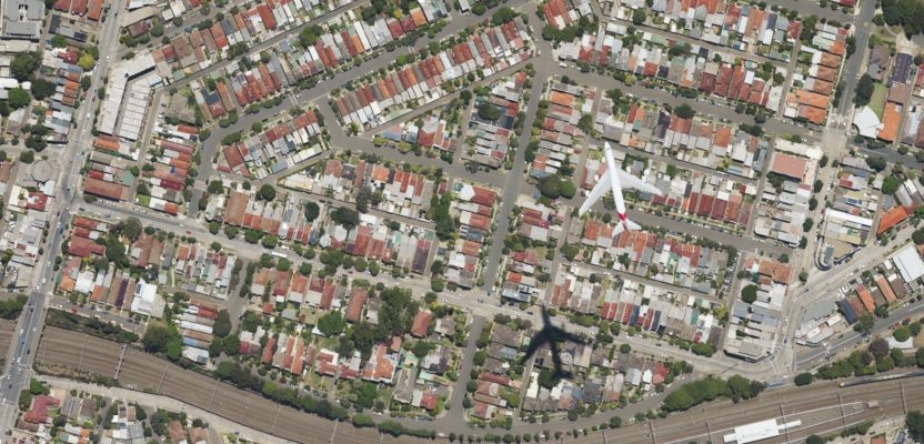
They have an IaaS (image as a service) in Australia, called MetroMap, mostly high res for major cities (at this time). Data can be accessed online via web browser, via WMS/WMTS, or digital/physical copy. But also, a growing library of 3D models. Might we see such a service expanded to the U.S.? Time will tell.
Value-added model and thematic data extraction are among their geo services. They’ve completed about 5,000 projects since 2000: aerial imaging, lidar, DTM/DSM development, feature extraction, change detection, classification, and city modeling. Projects have included piloted craft—planes and helicopters—but Aerometrex also integrates UAS where appropriate. They are no stranger to the U.S., having been involved in some major projects, including one where they worked with Bentley to develop a 3D model of sections of the City of Philadelphia, in part, to prepare for a Papal visit.

We’ll keep an eye on Aerometrex. One thing for sure … expansions of aerial firms shows us that the market for piloted/mixed aerial services remains strong and has not been eroded by UAS as much as some had predicted.