Category Archives: Lidar/Imaging
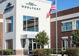
Woolpert Blends Methodology with Technology
What began as a four-person engineering and survey company in Ohio in 1911 has steadily evolved to become a full-service architecture, engineering, geospatial (AEG), and strategic consulting firm, with more than 1,600 staff and 60 offices on four continents. This fusion of AEG data breeds innovative products and solutions that address complex challenges worldwide, providing...
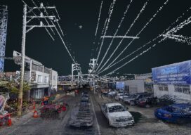
Street-Level Lidar On Demand
As exciting as the advent of on-demand access to current, high-resolution lidar is, so are the tools available for ingesting, extracting features, analyzing, and sharing. “What we’re hearing right now, this is really an inflection point for the industry,” says Phil Christensen, vice president for reality and spatial modeling at Bentley Systems. “The software has...
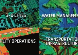
Providing Comprehensive Geospatial Solutions
Sanborn is a full-service geospatial company that has been in continuous operation since 1866. Today, Sanborn is an innovator in the modern geospatial industry, delivering state-of-the-art mapping, visualization, and 3D solutions for customers worldwide. Sanborn offers comprehensive geographic information solutions to city, county, regional, state, and federal government agencies, private companies, and international clients. Our...
Solving the Problems that Matter
Pickett and Associates provides aerial LiDAR and imagery, land surveying, hydrographic surveying, and engineering services to clients throughout the U.S. and Caribbean. Pickett specializes in offering the simultaneous collection of high resolution 4-Band Aerial Imagery together with engineering-grade airborne LiDAR, allowing us to turn around baseline imagery and LiDAR-derived data quickly and efficiently. We deliver...

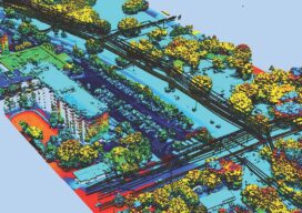
UAVs and Living Data
Digital twins are becoming important data for buildings and infrastructure in cities, but a utility in Chile is twinning its power corridors and adding seemingly unrelated data to identify, predict, and avoid power outages. We live in an era of combining technologies. For the past few decades, we have witnessed the most impressive movement of...
Geospatial Excellence
MAPPS recognizes the best geospatial projects of the year At its winter conference in Denver, MAPPS presented the annual Geospatial Excellence Awards to member firms whose entries exemplify the professionalism, value, integrity, and achievement of the firm’s staff as demonstrated over the previous year. The awards spotlight and honor the MAPPS members’ important and impactful...