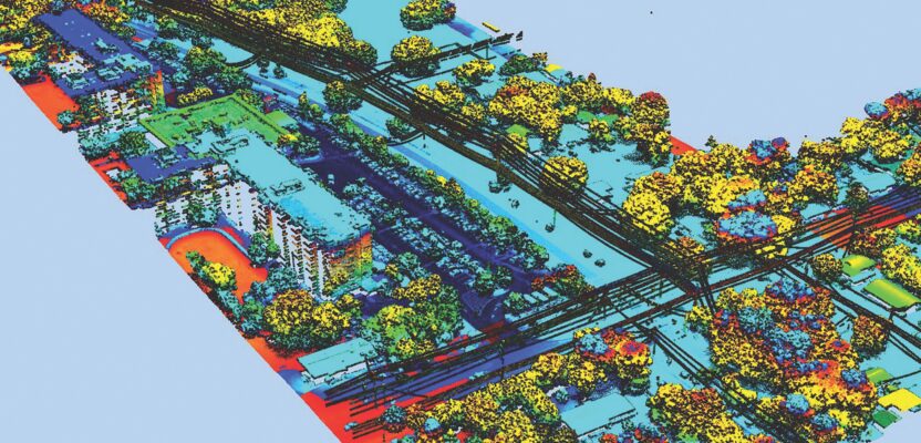
 Pickett and Associates provides aerial LiDAR and imagery, land surveying, hydrographic surveying, and engineering services to clients throughout the U.S. and Caribbean. Pickett specializes in offering the simultaneous collection of high resolution 4-Band Aerial Imagery together with engineering-grade airborne LiDAR, allowing us to turn around baseline imagery and LiDAR-derived data quickly and efficiently. We deliver CADD and GIS-ready products to meet unique client specifications in the energy, mining, waste management, and land development sectors. Our clients come to us for the most complex projects because of our proven track record of fulfilling our purpose ofsolving the problems that matter. They trust us to produce deliverables efficiently, safely, cost-effectively, and on schedule. With over 60 years of experience, we have established ourselves as leaders and innovators in the surveying and geospatial industry.
Contact us today to see how our geospatial services can benefit next your project.