With Trimble Catalyst Mobile Data Capture, City of Centennial Efficiently Proves GIS Accuracy
Sponsored content by Trimble
Since 2008, the City of Centennial, Colorado has partnered with global engineering company CH2M to manage its public works. The successful public-private partnership, often cited as a model of small government, has allowed the city and CH2M to streamline processes using a system that adjusts service quantities based on changing priorities and demands.
Like all municipalities, Centennial still depends on maps and other data sources to maintain aging infrastructure, manage weather events and respond to other customer needs. The partnership with CH2M only increased the need for fresh, robust, digital data.
CH2M’s senior geographic information system (GIS) specialist, John Londo turned to a mobile device using Trimble® Catalyst™, a software-defined Global Navigation Satellite System (GNSS) receiver for Android devices, integrated with Esri’s Collector for ArcGIS® app for field data collection.
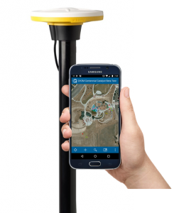
Trimble Catalyst and Esri Collector for ArcGIS running on an Android phone connected to the DA1 digital antenna
The breakthrough Catalyst technology delivers on-demand, precise positioning to Android devices, enabling specialists such as Londo to quickly and easily verify positions on personal smartphones and tablets.
Fast, accurate mapping. And smooth workflows.
Londo used Catalyst on an Android tablet connected to a pole-mounted Catalyst DA1 antenna and a dual-frequency, multi-constellation receiver.
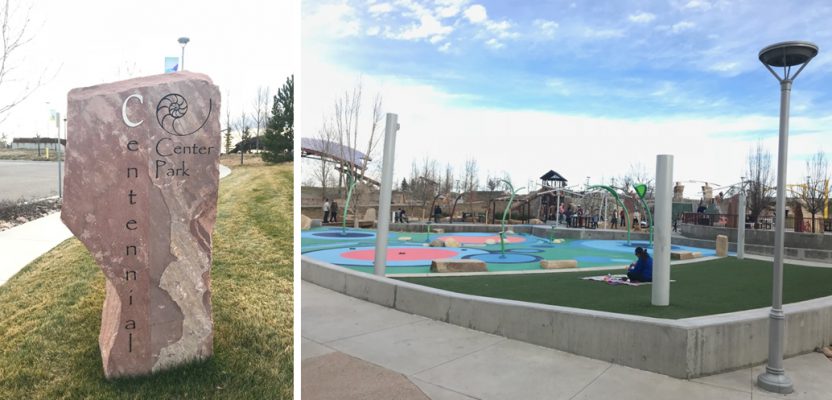
The setup enabled Londo to quickly, efficiently collect about 50 data points for a variety of public works assets across the city’s 11-acre Centennial Center park. And, because Catalyst integrates with a wide range of applications, he was able to add the data to Collector field software, a collaborative solution for the creation of maps, scenes, layers, analytics and data.
The process was smooth, efficient––fast.
Easy image collection. Without having to return.
The DA1 antenna, which is small and easy to transport, plugs into a phone or tablet. So Londo could collect precise data without transporting cumbersome equipment. And Catalyst’s subscription options gave CH2M the option of meter-level to centimeter-level accuracy, so the City of Centennial and its partner could choose the level of precision that fit the application.

Easily transportable Trimble Catalyst DA1 digital antenna
The system also eliminated the need to return to the field to double check what was collected. Londo was able to see and confirm all collected images on-the-fly, and capture any details he’d missed before heading back to the office.
Precise results in less time. Right in your pocket.
Catalyst and Collector saved Londo about two hours of processing time after a day of collecting data. For CH2M and the City of Centennial, it reduced costs and improved productivity, and greatly enhanced results by performing flawlessly with Collector.
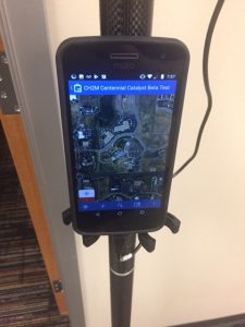
Android phone running Esri Collector for ArcGIS
After initial success with Trimble Catalyst and Collector for ArcGIS, Londo plans to use the solution in water and wastewater settings as he manages GIS for other projects in New Mexico, Florida and Georgia.
He expects to continue to enjoy exceptional results, whatever the application.
Learn more about Trimble Catalyst
Learn more about Esri Collector for ArcGIS