All posts by Jeff Thoreson
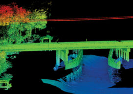
Teaching the Future
A small university on Michigan’s Upper Peninsula is educating the next generation of surveyors and geospatial engineers

Big Man Boone
Daniel Boone was a man. Yes a big man. With an eye like an eagle and as tall as a mountain was he. Daniel Boone was a man. Yes a big man. He was brave, he was fearless and as tough as a mighty oak tree. From the coonskin cap on the top of ol’...
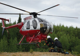
In Alaska, There’s Tough and There’s Survey Tough
On a survey job, Seth Kiester might find himself staying in a remote five-star hunting lodge. On the next job, he and the crew might be pitching tents hundreds of miles from civilization, encircling their makeshift camp with electrified wire to keep bears out.
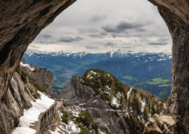
Lidar and Ice
Manfred Burchroithner grew up in the Austrian Alps not far from Eisriesenwelt, a stunning 26-mile long ice cave that is the largest in the world.
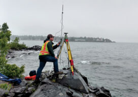
The Challenges of Near-shore Hydrographic Surveys
Near-shore hydrographic surveying can be a challenging task, especially if the conditions are not ideal to collect the required data.
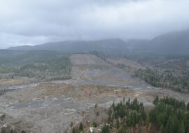
Landslide Bill Clears Congress; Labor Rescinds AAM 212
The passage of the National Landslide Preparedness Act by the U.S. Senate last week drew enthusiastic support from the National Society of Professional Surveyors (NSPS). The landslide bill passed by unanimous consent following earlier approval by the House of Representatives and clears the bill for signature into law by President Trump. Also last week the...