
Blog

xyHt Weekly News Recap: 6/30/17
CompassCom to Debut Enhanced CompassTrac Enterprise Mobile Resource Management Solution at Esri User Conference Teledyne Optech brings full spectrum of remote sensing technology to Esri UC 2017 Applanix and the University of Waterloo Collaborate on Advanced Guidance and Control Technologies for Autonomous Vehicles Deepest Underwater Consumer Drone from Blueye Robotics Reveals Ocean Depths Previously Unseen...
Free GIS Training
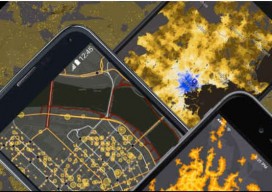
The ABCs of GIS via MOOC Massive open online courses (MOOCs) provide an affordable (generally free) and flexible way to learn new skills to advance or enhance your career or for your own personal development. The team over at Esri has joined the MOOC movement with five free GIS-related courses that require only a few...
xyHt Weekly News Links: 6/23/17
EngineerSupply Announces New Supply Line of Nedo Surveying Spectra Precision’s New GNSS Receiver Provides Surveyors with a Powerful Multi-application GNSS Solution Digital image evaluation heading for new markets Seiler Instrument Chooses TerraGo Magic to Build its Mobile GNSS App Platform Leica Geosystems offers complete imaging solution OrbitGT Announces Mobile Mapping Cloud Platform 3dmapping.cloud Property Drone...

HxGN LIVE 2017 Takeaways
The big buzz among those interested in laser scanning was Leica’s BLK360 laser scanner (pictured above as demonstrated to xyHt editor Gavin Schrock). The small, affordable ($16k) scanner was originally jointly announced by Leica Geosystems and Autodesk at AU 2016 in November. At HxGN LIVE 2017, attendees learned that scanner shipments had begun. The BLK360...

Dealing with Vertical Datum, the Mariners’ Way
Before 3D GIS, we were able to measure miles below the sea and miles beyond our own atmosphere to a great level of accuracy, so how did we do it? There are a few methods for working between vertical coordinate systems, but the one I want to discuss is possibly the simplest, not always the...
Mapping Rwanda: Surges Forward in UAS Mapping Use
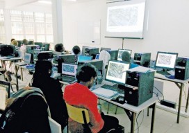
From cadastral to precision agriculture to humanitarian aid, UAS are making a big difference while mapping Rwanda. (Above: Course participants examine an orthomosaic in Pix4Dmapper during software training.) After Rwanda made waves in the news early last year for allegedly being the first country to approve drone delivery, people payed attention. The country, with its rolling...
Advertisement