
Blog
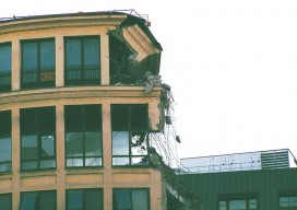
Shifting Ground: USGS on Earth Movement after an Earthquake
Ken Hudnut, science advisor for risk reduction, US Geological Survey, talks GPS and earthquakes. Editor’s note: In many ways, we are all participants in a grand scientific endeavor that’s on the cusp of helping humankind prepare for some of the most destructive natural hazards–earthquakes and volcanic eruptions. The fields of seismology, geodesy, and surveying have...

Weekly xyHt News Links: 6/16/17
RIEGL has received the Sebastian Sizgoric Technical Achievement Award at this year’s JALBTCX conference in Savannah, Georgia. Record attendance for GEO Business 2017 Identified Technologies Aligns with DJI to Offer Best-in-class Commercial Drone Solution Survey and Mapping Company Partners with Leading Unmanned and Manned Flight Service Experts Aeroscout launches UAV helicopter for high-altitude flight Congress increases funding...

“Next Big Thing” Essay Winner: Bring the Old and New Together
Bring the Old and New Together The next big thing for the surveying profession is much more than a new instrument or the use of a new technology. To me, it is something much more profound than that. I recently read a statistic in an article printed in the Gem State Surveyor, the quarterly publication...
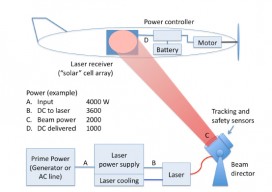
Laser-powered UAS
As noted in our latest issue about tethered drones, the ability to power UAS from the ground exponentially increases flight times and allows the use of heavier sensor payloads. Tethering accomplishes this at the cost of range, however: generally 200-400’ with commercially available tethering systems. What if a system had the advantages of tethering and...

The iCon build: Adding Adaptable Options for Layout Automation
Leica’s “iCon build” solves a common layout automation conundrum for vertical construction firms, large and small. Editor’s note: The benefits of automation for vertical construction are not limited to projects that have implemented full-on, single-environment BIM. Many firms and projects can now use a realistic and practical mix of old and new workflows and technologies during...
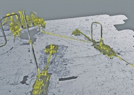
Surveying a Mile Down
Above: The metrology viewed as a combined model. A 3D surveying company provides highly detailed lidar data on subsea drill centers. This article almost didn’t happen. I first met with ADUS DeepOcean in January 2017, when we discussed how they had captured high-resolution laser data deep in the ocean off Ghana. Today, four months later, I...
Advertisement